New blog post: Accessing Planetary Computer STAC files in DuckDB - see https://blog.rtwilson.com/accessing-planetary-computer-stac-files-in-duckdb/

This is a report of my experimentation on how to access STAC GeoParquet files provided by Planetary Computer in DuckDB - I struggle a bit with authentication and libraries, but get it working after a while.
#geospatial #python #duckdb #PlanetaryComputer

Accessing Planetary Computer STAC files in DuckDB « Robin's Blog

Given the lack of outrage (outside my WhatsApp peers) on the demise of #PlanetaryComputer , I guess not many #earthobservation peeps used it. Such a shame.... Cool open technology!
So #Microsoft is retiring the #PlanetaryComputer Hub, which allowed you to do quite advanced analyses using standard #Python packages. I guess we can run it elsewhere, and this was always on the cards, that's why using a standard #pangeo setup was good, but as with all things cloud, it's infuriating!!!
@hughagraham @esa Depending on what type of SAR data you'll use, you can often (application dependent) get away with using already RTC'ed ARD data (e.g., from #PlanetaryComputer), and by using fairly simple speckle reduction filters (mostly, they are ways of cleverly blurring images). For polarimetric or interferometic data, things are more complex. Let us know how you're getting on!

Have you wanted to use segment-geospatial (https://samgeo.gishub.org/) on Microsoft Planetary Computer and struggled? My blog post shows the simple solution: https://blog.rtwilson.com/how-to-get-segment-geospatial-working-on-microsoft-planetary-computer/

#python #ml #segmentation #PlanetaryComputer #geospatial #gis

segment-geospatial

Who is using Microsoft's Planetary Computer? This is a good little summary for those who are wondering what it is about https://gogeomatics.ca/the-microsoft-planetary-computer-and-cloud-based-gis/ #datascience #PlanetaryComputer
The Microsoft Planetary Computer and Cloud Based GIS

Microsoft has developed an online, open-source tool called The Microsoft Planetary Computer. One of the many struggles when performing geospatial analysis on a global scale is the sheer volume of d…

GoGeomatics
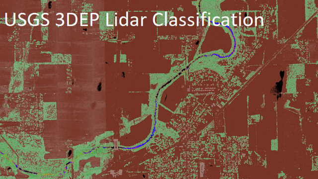
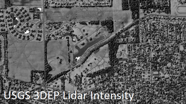
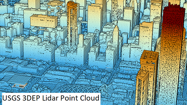
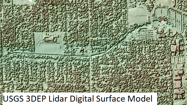
USGS 3DEP LiDAR Collection @ Microsoft
--
https://planetarycomputer.microsoft.com/dataset/group/3dep-LiDAR <-- Microsoft data / use case portal
--
“To respond to growing needs for high-quality elevation data, the goal of 3DEP is to complete acquisition of nationwide lidar (IfSAR in AK) to provide the first-ever national baseline of consistent high-resolution topographic elevation data – both bare earth and 3D point clouds. This dataset provides the raw 3D point clouds in the Cloud Optimized Point Cloud format, and various derived products as Cloud Optimized GeoTIFFs…”
#GIS #spatial #mapping #gischat #3dep #elevation #opendata #planetarycomputer #LiDAR #ifsar #USA #nationwide #acquistion #topography #topographic #dem #bareearth #pointclouds #cloudoptimization #geotiffs #download #library #usgs #microsoft
@microsoft @usgs
Microsoft Planetary Computer

Supporting sustainability decision-making with the power of the cloud

day 23: 3d
with bonus animation.

same corner of Sussex used on the Day 17. Elevation data from Copernicus Gloabl DEM (ESA) via #PlanetaryComputer.

DEM --> TIN accomplished with by randomly sampling the DEM, and using `matplotlib.tri.Triangulation`

first time mucking about with a TIN. ditto animation. and #matplotlib can do them both.

code: https://github.com/tlohde/30DMC/tree/main/2023

#30DayMapChallenge

30DMC/2023 at main · tlohde/30DMC

Contribute to tlohde/30DMC development by creating an account on GitHub.

GitHub

day 20: outdoors
summit views

aggregating viewsheds for all peaks within the cairngorms national park. brighter areas can be seen from more hill tops.

Cac Càrn Beag (1156 m) in the south east of the park wins the most visible prize: (can be seen from 289 other summits)

peaks and cairngorms boundary from #OpenStreetMap. DEM from Copernicus Global 30 m DEM via #PlanetaryComputer. viewshed analysis run with #gdal.

code: https://github.com/tlohde/30DMC/tree/main/2023

#30DayMapChallenge

30DMC/2023 at main · tlohde/30DMC

Contribute to tlohde/30DMC development by creating an account on GitHub.

GitHub

day 18: atmosphere
wanted to do something with weather balloons....couldn't readily find the sort of data i was after.

INSTEAD: the utility of #sar. a pair of acquisitions from Sentinel-2 (cloudy) and Sentinel-1 (cloud-free) over Panama.

Contains Copernicus Sentinel Data (ESA) accessed via #PlanetaryComputer using #pystac and #stackstac

code: https://github.com/tlohde/30DMC/tree/main/2023

#30DayMapChallenge

30DMC/2023 at main · tlohde/30DMC

Contribute to tlohde/30DMC development by creating an account on GitHub.

GitHub