LA NOTIZIA: Il meteo divide in due l’Italia: al Nord previste piogge, mentre al Sud persiste il caldo anomalo
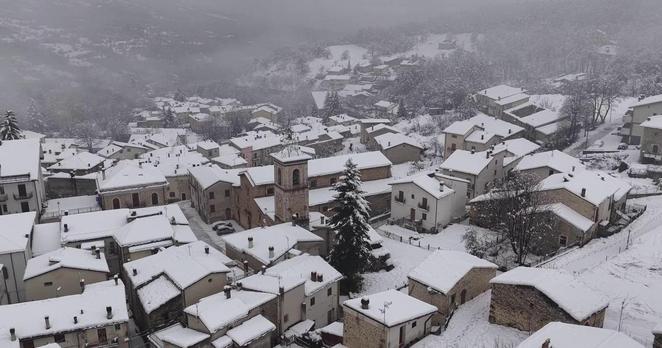
Il meteo, con l’ultimo brusco cambiamento, divide in due l’Italia. A raccontarlo è Lorenzo Tedici, meteorologo responsabile media de iLMeteo.it, secondo cui al Nord domina l’instabilità, accompagnata da un sensibile calo delle temperature, mentre al Centro-Sud persistono sole e caldo anomalo, con punte di 26-28 °C.
Domani la situazione evolverà ulteriormente, con l’ingresso di aria fresca proveniente dai Balcani, che farà scendere le temperature su tutta la Penisola. Per effetto di questo ennesimo stravolgimento, tra oggi e domani saranno possibili rovesci isolati e di breve durata, soprattutto al Nord-Ovest e lungo la fascia adriatica. Non si esclude, però, che le precipitazioni possano interessare a macchia di leopardo anche il resto del Paese.
Il meteo divide in due l’Italia: al Nord previste piogge, mentre al Sud persiste il caldo anomalo
Fortunatamente questa parentesi di maltempo sembra avere le ore contate. Secondo i modelli previsionali, già da venerdì 1° maggio assisteremo a un nuovo cambio di scenario, con il sole che tornerà a prevalere su gran parte dell’Italia. Nonostante la scarsa nuvolosità, le temperature si assesteranno intorno ai 22-23 °C, regalando un weekend all’insegna di un clima mite.
Il vento, che in queste ore sta spazzando il Paese, si attenuerà sensibilmente. Tutto, però, cambierà di nuovo all’inizio della prossima settimana, quando al Nord tornerà il maltempo, con piogge diffuse e intense. Di conseguenza si registrerà un calo termico significativo, che potrebbe portare persino a qualche nevicata sulle cime più alte delle Alpi. Un peggioramento che, nei giorni successivi, potrebbe estendersi anche alle regioni del Centro-Sud.
L'articolo Il meteo divide in due l’Italia: al Nord previste piogge, mentre al Sud persiste il caldo anomalo sembra essere il primo su LA NOTIZIA.
The weather divides Italy in two: rain is expected in the North, while the abnormal heat persists in the South.
The weather, with the latest abrupt change, has divided Italy in two. According to Lorenzo Tedici, meteorologist responsible for media at iLMeteo.it, the North is dominated by instability, accompanied by a significant drop in temperatures, while the Center-South continues to experience sunshine and abnormal heat, with peaks of 26-28 °C.
Tomorrow the situation will further develop, with the entry of fresh air from the Balkans, which will cause temperatures to drop across the Peninsula. As a result of this latest upheaval, isolated and short-lived showers may occur between today and tomorrow, especially in the Northwest and along the Adriatic coast. However, it is not excluded that precipitation may also affect the rest of the country in patches.
The weather has divided Italy in two: rain is expected in the North, while abnormal heat persists in the South.
Fortunately, this period of bad weather seems to be drawing to a close. According to forecasting models, as early as Friday, May 1st, we will witness a new change of scenery, with the sun returning to dominate much of Italy. Despite the low cloud cover, temperatures will stabilize around 22-23 °C, offering a weekend of mild weather.
The wind, which is currently sweeping across the country, will diminish significantly. However, everything will change again at the beginning of next week, when the bad weather will return to the North, with widespread and intense rains. As a consequence, there will be a significant drop in temperature, which could even bring snow to the highest peaks of the Alps. This deterioration could then extend to the regions of the Center-South in the following days.
#Italy #North #South #LorenzoTedici #Balkans #Peninsula #Northwest #Adriatic #22-23 #theCenter-South
https://www.lanotiziagiornale.it/meteo-nord-piogge-sud-caldo-anomalo/