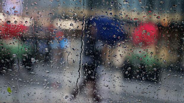
ERCA says 20 to 30 millimetres of rain fell overnight in some spots across the region, with more forecasted throughout the day.
https://www.cbc.ca/news/canada/windsor/heavy-rainfall-windsor-essex-flood-advisory-9.7123921?cmp=rss
Flood Advisory (despite LA lifting their evac warnings... interestingly)
1158 AM PST Thu Feb 19 2026
...FLOOD ADVISORY IN EFFECT UNTIL 1 PM PST THIS AFTERNOON...
* WHAT...Flooding caused by excessive rainfall is expected.
* WHERE...A portion of southwest California, including the following
county, Los Angeles.
* WHEN...Until 100 PM PST.
* IMPACTS...Minor flooding in low-lying and poor drainage areas.
* ADDITIONAL DETAILS...
- At 1158 AM PST, Doppler radar indicated heavy rain. Minor
flooding is ongoing or expected to begin shortly in the
advisory area.
- Some locations that will experience flooding include...
Long Beach, eastern Malibu, Inglewood, Manhattan Beach,
Culver City, Hermosa Beach, Venice, Redondo Beach, Torrance,
Santa Monica, Beverly Hills, Downtown Los Angeles, Hollywood,
Rancho Palos Verdes, Encino and Agoura Hills.
- http://www.weather.gov/safety/flood
Oh my
#FloodAdvisory for Santa Barbara and Ventura County
Flood Advisory
National Weather Service Los Angeles/Oxnard CA
833 PM PST Tue Feb 10 2026
CAC083-111-110730-
/O.NEW.KLOX.FA.Y.0020.260211T0433Z-260211T0730Z/
/00000.N.ER.000000T0000Z.000000T0000Z.000000T0000Z.OO/
Santa Barbara CA-Ventura CA-
833 PM PST Tue Feb 10 2026
...FLOOD ADVISORY IN EFFECT UNTIL 1130 PM PST THIS EVENING...
* WHAT...Flooding caused by excessive rainfall is expected.
* WHERE...The eastern Santa Ynez Mountains to the western Ventura
County mountains and foothills.
* WHEN...Until 1130 PM PST.
* IMPACTS...Minor flooding in low-lying and poor drainage areas.
Rises in small streams and normally dry arroyos.
* ADDITIONAL DETAILS...
- At 829 PM PST, Doppler radar indicated heavy rain. Minor
flooding is ongoing or expected to begin shortly in the
advisory area. Between 0.5 and 1 inch of rain has fallen.
- Additional rainfall amounts of 0.5 to 1 inch are expected
over the area. This and additional rain will result in minor
flooding in spots.
- Some locations that will experience flooding include...
Santa Barbara, Ojai, Montecito, Carpinteria, Summerland, Rose
Valley, Lake Casitas, Highway 33 between Wheeler Springs and
Rose Valley Road, Meiners Oaks, Solimar Beach, Mission
Canyon, Highway 154 over San Marcos Pass and Santa Barbara
Airport.
- http://www.weather.gov/safety/flood
Local flood advisory issued, today in The Watershed: https://www.lionsbaywatershed.ca/post/weekend-flood-advisory-issued
#LionsBayWatershed #LocalNews #Flood #FloodAdvisory #SouthCoast #LionsBay #Vancouver #Nature

Environment Canada issues coastal flood warning for SundayEnvironment Canada has issued a Flood Advisory for low-lying areas around the South Coast, including Lions Bay, throughout the upcoming weekend. The strongest chance of flooding is expected Sunday. The combination of very high tides and the current low-pressure system could lead to moderate coastal flooding, according to the government agency. Current tide patterns are at a seasonal high, and the concern is that the strong winds and resul
A flood watch is in effect for parts west. The screen shot shows the #NCwx low country catching it. Thereβs another slower blob of rain south of Richmond that is working over Tobacco Road.
An advisory was just sounded and put on the broadcast. Iβve not listened to it yet but it does include the Wakefield AOR inside the mesoscale discussion area.
Good evening to review your flood safety plan.
π
Flood Advisory
National Weather Service Phoenix AZ
1244 PM PDT Sun May 4 2025
...FLOOD ADVISORY IN EFFECT UNTIL 445 PM PDT THIS AFTERNOON...
* WHAT...Flooding caused by excessive rainfall is expected.
* WHERE...A portion of southern California, including the following
counties, Riverside and San Bernardino.
* WHEN...Until 445 PM PDT.
* IMPACTS...Minor flooding in low-lying and poor drainage areas.
Ponding of water is occurring or is imminent.
* ADDITIONAL DETAILS...
- At 1244 PM PDT, Doppler radar indicated heavy rain due to
thunderstorms. Minor flooding is ongoing or expected to begin
shortly in the advisory area. Up to 1 inch of rain has
fallen.
- This includes the following streams and drainages...
Seco, Arroyo.
- Some locations that will experience flooding include...
Desert Center, Chiriaco Summit and Eagle Mtn.
- http://www.weather.gov/safety/flood
PRECAUTIONARY/PREPAREDNESS ACTIONS...
Turn around, don't drown when encountering flooded roads. Most flood
deaths occur in vehicles.
Please report observed flooding to local emergency services or law
enforcement and request they pass this information to the National
Weather Service when you can do so safely.
&&
π€
Flood Advisory
National Weather Service Los Angeles/Oxnard CA
531 PM PDT Fri May 2 2025
...FLOOD ADVISORY IN EFFECT UNTIL 730 PM PDT THIS EVENING...
* WHAT...Urban and small stream flooding caused by excessive
rainfall is expected.
* WHERE...A portion of southwest California, including the following
counties, Santa Barbara and Ventura.
* WHEN...Until 730 PM PDT.
* IMPACTS...Minor flooding in low-lying and poor drainage areas.
* ADDITIONAL DETAILS...
- At 531 PM PDT, Doppler radar indicated heavy rain due to
thunderstorms. This will cause urban and small stream
flooding.
- Some locations that will experience flooding include...
Lockwood Valley, Highway 33 from Lockwood Valley Road to the
Santa Barbara County line, Ventucopa and Frazier Mountain.
- RAT
&&
NWS Los Angeles/Oxnard