Census of Illegally Abandoned Boats & Ships – Venetian Lagoons & Wetlands
--
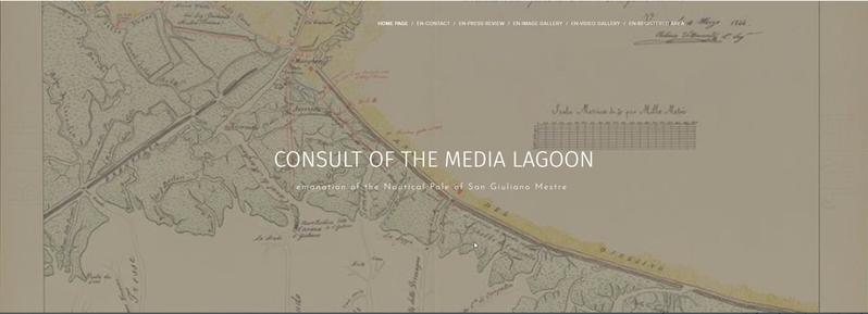
https://www.lagunamedia.it/relitti2/ <-- Italian version with survey info
--
https://www.theguardian.com/environment/2023/jan/10/venices-lagoon-of-2000-lost-boats-the-true-cost-of-dumping-small-vessels <-- news article with background
--
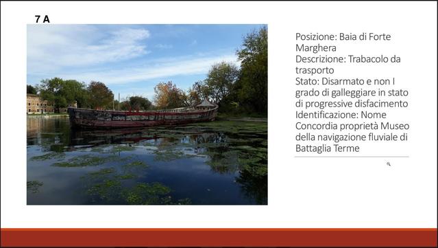
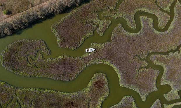
Paolo Cuman points to a rusty boat, half-sunk in Venice’s lagoon. “It has been there for years,” he says, laughing. “When I manage to have her removed, I’ll open a bottle of good wine.” Hunting abandoned boats is a hobby for Cuman, the coordinator of the Consulta della Laguna Media, a grassroots group monitoring the health of the lagoon. Once he’s found the boats, he maps them [link above] and pressures the authorities to remove them…”
#GIS #spatial #mapping #survey #citizenmapping #activitism #venice #italy #venezia #dumping #boats #ships #venetian #lagoon #wetlands #citizenengagement #illegal #barene #tidal #hazard #shipping #abandoned #bureaucracy #environment #ecology #hydrology #health