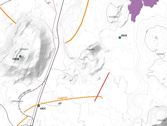
This map shows the location of the current #eruption in #Iceland (red line) relative to the previous flows (purple) and the protective berms (orange), indicating it has cut through one of those #berms already. The current flow is less than 500 m away from the town of #Grindavík.
https://vedur.is/um-vi/frettir/jardskjalftahrina-nordan-vid-grindavik-hofst-i-nott