3D Coastal Mapping [New Zealand]
--
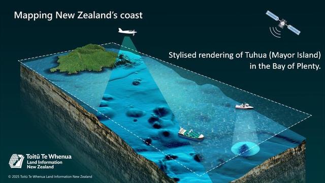
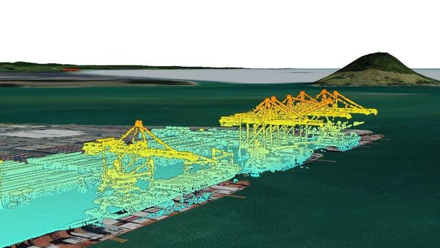
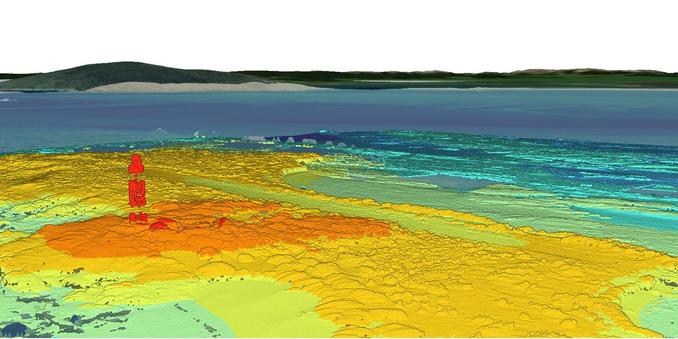
https://www.linz.govt.nz/products-services/data/3d-coastal-mapping <-- shared technical overview
--
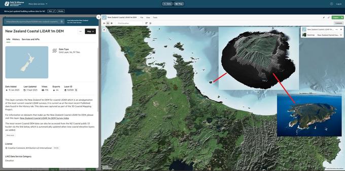
https://data.linz.govt.nz/layer/122508-new-zealand-coastal-lidar-1m-dem/ <-- shared New Zealand Coastal LiDAR 1m DEM
--
#GIS #spatial #mapping #coast #coastal #opendata #NewZealand #remotesensing #LiDAR #earthovservation #3D #3DCM #climatechange #sealevel #sealevelrise #SLR #risk #hazard #spatialdata #mitigation #topography #bathymentry #geomorphmetry #humanimpacts #seafloor #marine #ocean #policy #planning #communities #infrastructure #biodiversity #habitat #tsunami #earthquake #RingOfFire #flood #innundation #flooding #LINZ #hydrology #hydrography #maritime #safety
@Toitū Te Whenua Land Information New Zealand @LINZ
--
https://www.linz.govt.nz/products-services/data/3d-coastal-mapping <-- shared technical overview
--
https://data.linz.govt.nz/layer/122508-new-zealand-coastal-lidar-1m-dem/ <-- shared New Zealand Coastal LiDAR 1m DEM
--
#GIS #spatial #mapping #coast #coastal #opendata #NewZealand #remotesensing #LiDAR #earthovservation #3D #3DCM #climatechange #sealevel #sealevelrise #SLR #risk #hazard #spatialdata #mitigation #topography #bathymentry #geomorphmetry #humanimpacts #seafloor #marine #ocean #policy #planning #communities #infrastructure #biodiversity #habitat #tsunami #earthquake #RingOfFire #flood #innundation #flooding #LINZ #hydrology #hydrography #maritime #safety
@Toitū Te Whenua Land Information New Zealand @LINZ