Honestly, they're not sending their best. They're criminals, they're rapists, they're slavers. And some, I assume, are good people
Honestly, they're not sending their best. They're criminals, they're rapists, they're slavers. And some, I assume, are good people
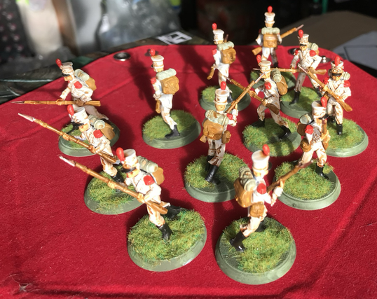
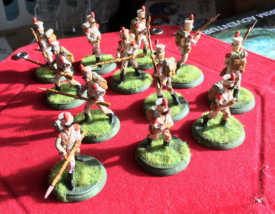
Have my Mexican Lost Army troops ready for the session tomorrow. Used #armypainter acrylics for a change, with a Sepia wash to get that weathered look, and the mummified flesh.
They are nasty in #shadowsofbrimstone - NEVER stand where they can approach you in formation, those volleys kill you quickly.
Uniform I chose is based on the #mexican army of #SantaAnna 1835ish, summer colours, grenadiers. I liked the clean look.
#miniaturepainting #miniaturegames #dungeoncrawler #rpg #gaming
(Crappy photography all mine too)
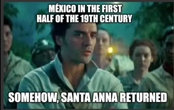
Mexico on repeat, someone fix the record player
https://piefed.social/c/historymemes/p/1763079/mexico-on-repeat-someone-fix-the-record-player

¡NUEVO MORDISCO!
Mucho se ha hablado de Santa Anna, pero pocos recuerdan bien su etapa dictatorial. Aquí te la explicamos brevemente.
Sigue el enlace: https://zurl.co/cW4ae

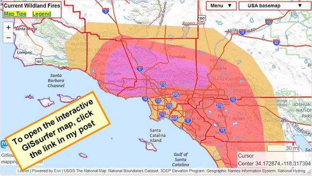
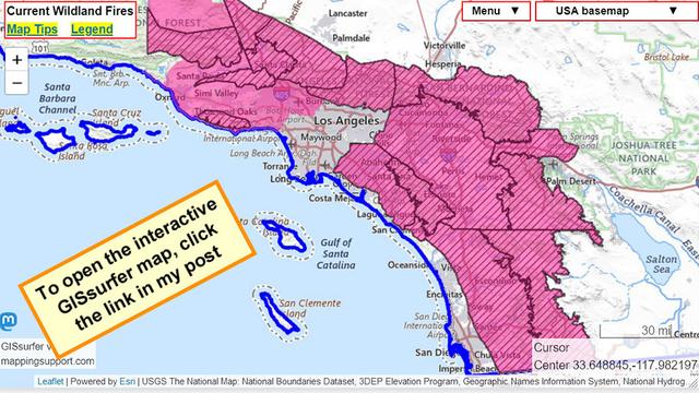
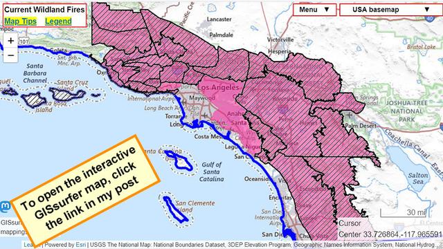
#HighWindWarning - Diagonals - Expanded area.
#RedFlagWarning - Red shading - Through Friday morning.
For official details from NOAA including timing, open the map, zoom in, click in red area. Scroll down in the popup that appears since there might be multiple weather watches/warnings for the spot you clicked and each one has its own link to the details.
#SantaAnna #CAfire #CAwx #Wildfire #HughesFire
Not done yet.
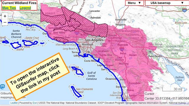
#HighWindWarning - Diagonals
#RedFlagWarning - Red
For official details from NOAA including timing, open the map, zoom in, click in red area. Scroll down in the popup that appears since there might be multiple weather watches/warnings for the spot you clicked and each one has its own link to the details.
#LAfires #SantaAnna #CAfire #CAwx #Wildfire
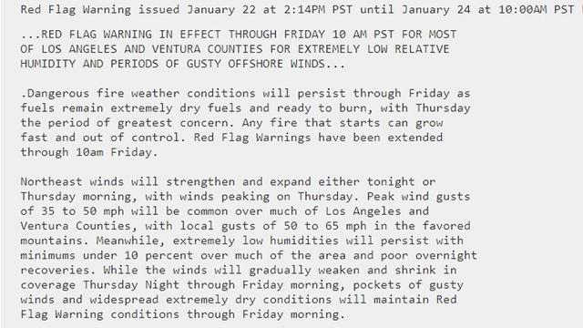
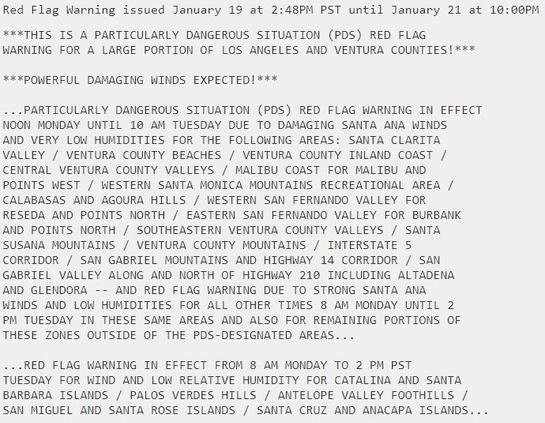
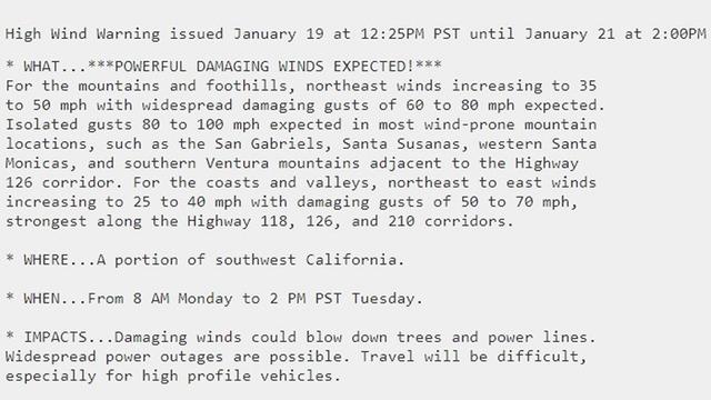
“PARTICULARLY DANGEROUS SITUATION (PDS)” (NOAA’s caps)
Normal red flag warning starts 8am Monday.
PDS red flag warning starts noon Monday.
Same scenario as when Palisades and Eaton fires started.
Map legend:
#HighWindWarning - Diagonals
#RedFlagWarning - Red
For official details from NOAA including timing, open the map, zoom in, click in red area. Scroll down in the popup that appears since there might be multiple weather watches/warnings for the spot you clicked and each one has its own link to the details.
#LAfires #SantaAnna #CAfire #CAwx #Wildfire

Sunday morning.
This map always shows NOAA’s “Fire Weather Outlooks” for the following day. At the time of my post, that would be Monday.
There are three levels based on forecasts for wind and humidity. NOAA designates those levels as Elevated, Critical and Extreme. On this map the area classified as Extreme is purple.
#LAfires #SantaAnna #CAfire #CAwx #Wildfire