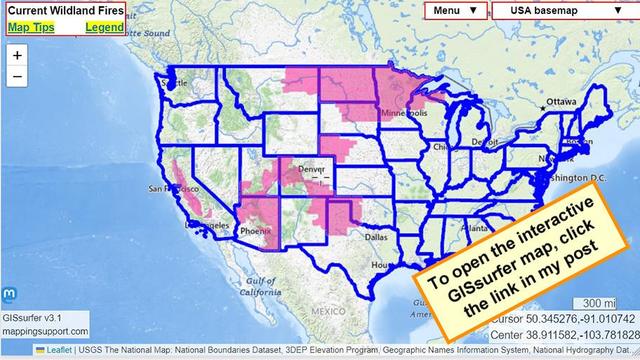
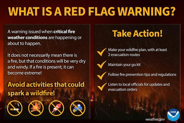
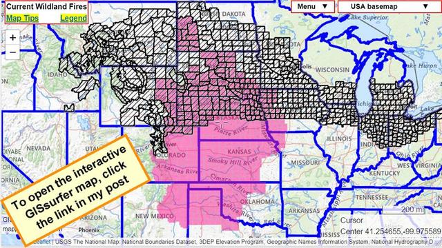
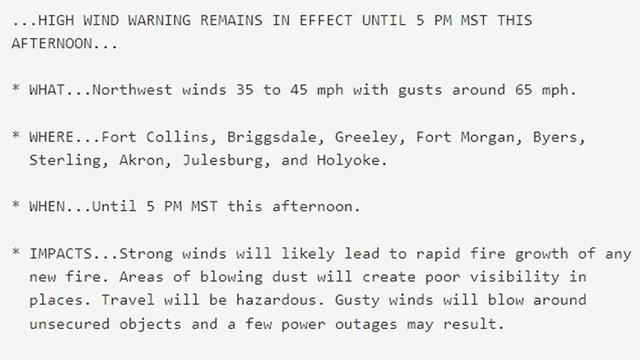
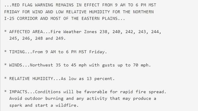
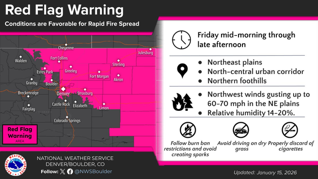
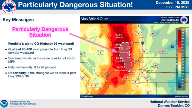
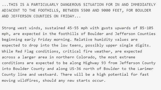
Lots of red flag warnings. Lets try to not burn the place down.
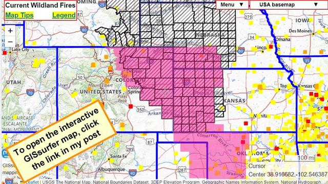
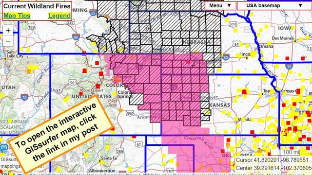
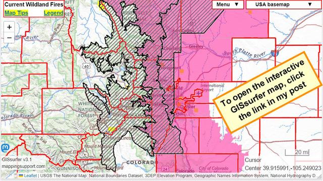
For details from NOAA - including timing - open the map, click colored area, follow the link. Since the spot you clicked might have more than one type of watch/warning, scroll down in the popup since each type of watch or warning has its own link for the details.
H/T @MiBaWi
#RedFlagWarning #Firewx #WildlandFire