Integrated Topographic Corrections Improve Forest Mapping Using Landsat Imagery
--
https://doi.org/10.1016/j.jag.2022.102716 <-- shared 2022 paper
--
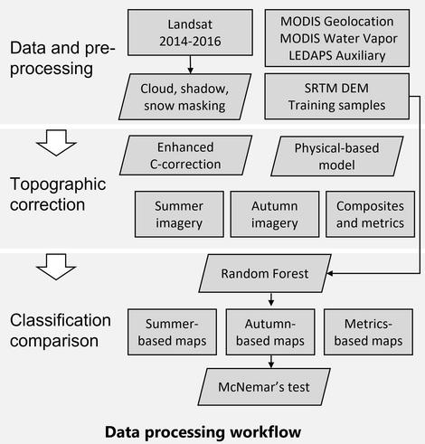
“HIGHLIGHTS:
• [They] evaluated the impacts of topographic correction on forest mapping in the mountains.
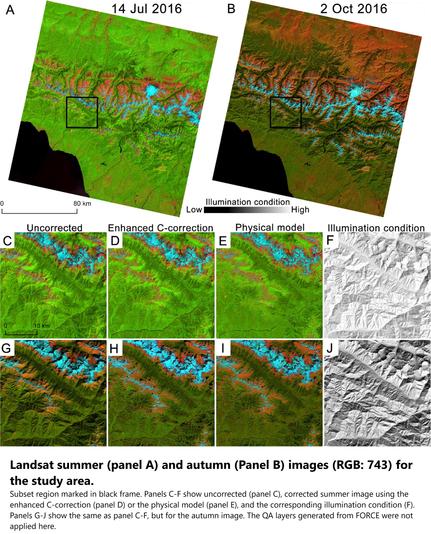
• The enhanced C-correction and the physical model reduced topographic effects.
• The corrected Landsat imagery time series resulted in higher accuracy.
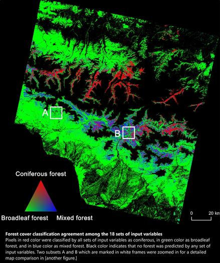
• Terrain information improved classification but not as much as topographic correction.
• [They] recommend using topographic correction for forest cover mapping..."
#GIS #spatial #AtmosphericCorrection #IlluminationCondition #LandCover #ModelComparison #TimeSeries #TopographicCorrection #remotesensing #comparasion #topographic #correction #NDVI #forest #vegetation #model #modeling #spatialanalyis #accuracy #forestcover #Russia #Georgia #CaucasusMountains #spatiotemporal #landsat #elevation #DEM
--
https://doi.org/10.1016/j.jag.2022.102716 <-- shared 2022 paper
--
“HIGHLIGHTS:
• [They] evaluated the impacts of topographic correction on forest mapping in the mountains.
• The enhanced C-correction and the physical model reduced topographic effects.
• The corrected Landsat imagery time series resulted in higher accuracy.
• Terrain information improved classification but not as much as topographic correction.
• [They] recommend using topographic correction for forest cover mapping..."
#GIS #spatial #AtmosphericCorrection #IlluminationCondition #LandCover #ModelComparison #TimeSeries #TopographicCorrection #remotesensing #comparasion #topographic #correction #NDVI #forest #vegetation #model #modeling #spatialanalyis #accuracy #forestcover #Russia #Georgia #CaucasusMountains #spatiotemporal #landsat #elevation #DEM