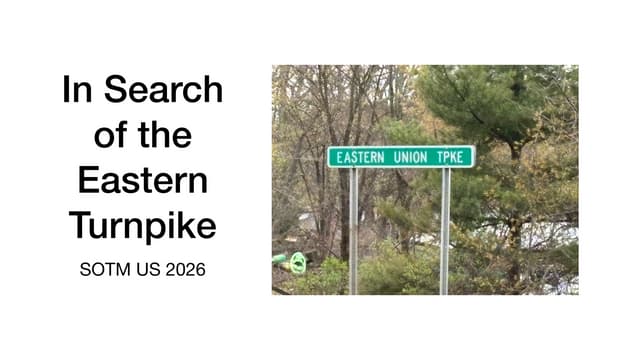
just sent my presentation slides for #sotmus26 to the conference organizers. also, just put them on SlideShare
"In Search of the Eastern Turnpike"
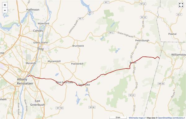
mapping the highway from the early 1800s in Rensselaer County, New York. #openhistoricalmap #OpenStreetMap
https://www.slideshare.net/slideshow/openhistoricalmap-in-search-of-eastern-turnpike/287966901
OpenHistoricalMap: In Search of Eastern Turnpike
A look at the research process used in identifying the path of the Eastern Turnpike in Upstate New York in the early 1800s, and mapping the route in OpenHistoricalMap. Topics include online sources and access to Historical Archives & local historians. - Download as a PDF or view online for free