@CharliePlett

9 Followers
5 Following
12 Posts
Mapper on OHM and OSM.
The sustainability and future of @OpenStreetMapUS Charter Projects @MapRoulette, @ohm and OSMCha are in jeopardy. We were able to hire our awesome software engineer, Jake Low, last year thanks to generous financial support from corporate OSM users. But most still keep OSM for granted, pouring $ into things like Overture instead (they are hiring for a new ED with a salary that is almost as much as our entire annual budget). Read our latest blog post and please share. https://openstreetmap.us/news/2025/07/charter-projects-face-uncertain-future/
Charter Projects Face Uncertain Future as Financial Support Ends

Many of the best OpenStreetMap tools emerge organically as personal projects built by members of the global community. Informal structures can be great for getting a project off the ground, but at some point...

I have now mapped the history of the Spanish Empire including it's viceroyalties and captaincy generals on OpenHistoricalMap.

https://commons.wikimedia.org/wiki/File:SpanishEmpireTimelapse.webm

https://www.openhistoricalmap.org/user/CharliePlett/diary/43

#openhistoricalmap #qgis #spanishempire

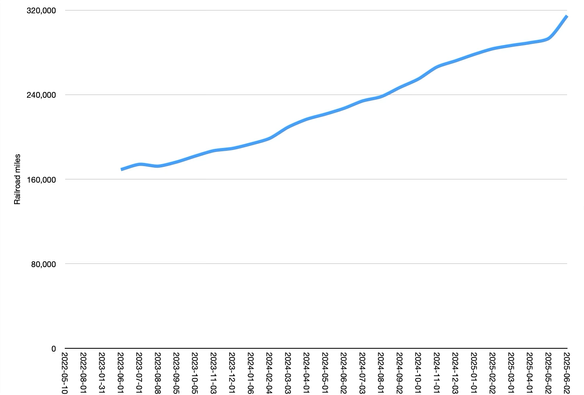
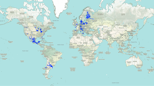
We’ve never seen such a sharp uptick in new railroad coverage like we’ve experienced in May, particularly in present-day Argentina, Finland, and Mexico.

My OpenStreetMap daily edit graph has taken a beating since I started mapping exclusively on OpenHistoricalMap.

#openhistoricalmap #openstreetmap

OpenHistoricalMap and open source software let you tell stories in the proper historical context:

https://mastodon.social/@CharliePlett/114247969119307235

Learn how to incorporate OHM into your own project:

https://wiki.openstreetmap.org/wiki/OpenHistoricalMap/Reuse

#dataviz

OpenHistoricalMap/Reuse - OpenStreetMap Wiki

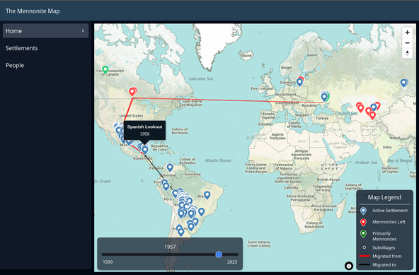
I created a website called https://themennonitemap.org where I'm displaying all Mennonite villages that have ever existed. When you click on a settlement it changes the map date to the founding date of the village.
#openhistoricalmap #mennonite #maplibre
The Mennonite Map

Some cool interactive Mennonite history maps of settlements and people.

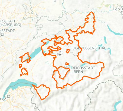
I spent way too much time on mapping the Free Imperial City of Bern. The chronology has 56 relations.

https://www.openhistoricalmap.org/relation/2852037

#Bern #Switzerland #HRE

Relation: ‪Free Imperial City of Bern‬ (‪2852037‬)

OpenHistoricalMap is an interactive map of the world throughout history, created by people like you and dedicated to the public domain.

OpenHistoricalMap

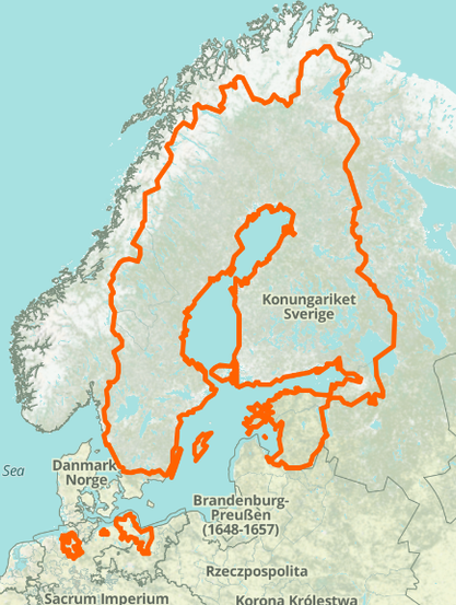
This week I mapped Sweden in high detail from the year 1000-present day

https://www.openhistoricalmap.org/relation/2851869

Sweden in 1650
@ohm

#ohm #sweden #swedishempire #finland

Relation: ‪Swedish Empire‬ (‪2851869‬)

OpenHistoricalMap is an interactive map of the world throughout history, created by people like you and dedicated to the public domain.

OpenHistoricalMap

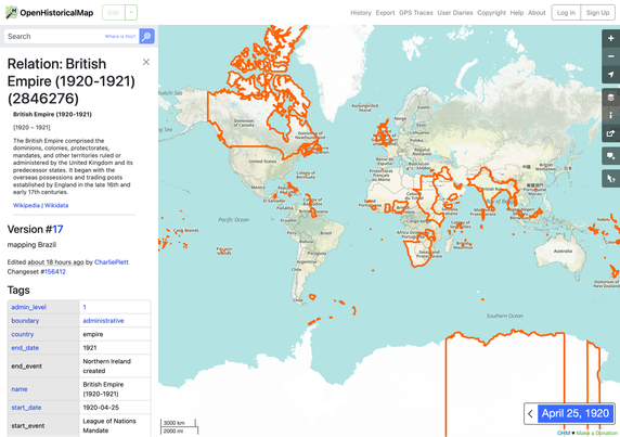
It took @CharliePlett several months to map the British Empire and the hundreds of boundary changes involving its subdivisions and dependencies over the centuries. We’re a bit relieved it’s over – the huge boundary changes came close to melting the server a few times. Get a peek behind the scenes of this project from our intrepid mapper:

https://www.openhistoricalmap.org/user/CharliePlett/diary/35

#BritishEmpire

British Empire fully mapped

I started mapping on OpenHistoricalMap in 2019 because of things I had to erase on OpenStreetMap that I wanted recorded for histories sake.

OpenHistoricalMap