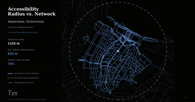
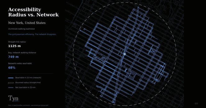
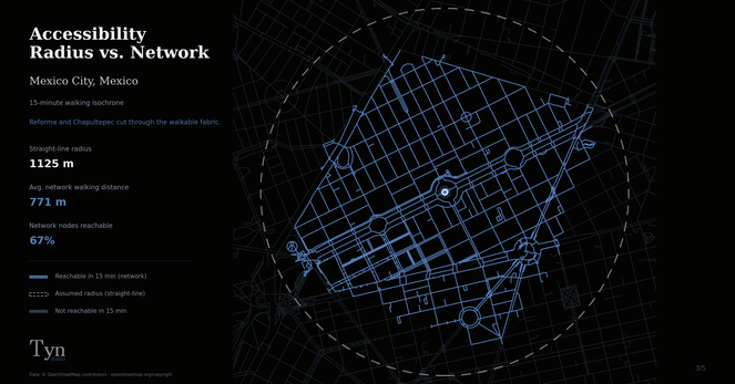
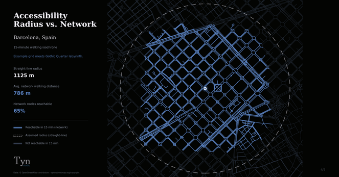
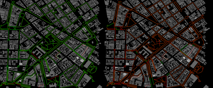
I was once in a discussion with policy makers about giving better loan terms based on walkability. Good idea. But they were measuring it as a straight-line radius. Draw a circle, count what's inside.
When I looked at the actual pedestrian network, the story is quite different! Not everything is accessible. Private roads, a highway with no crossing, cul-de-sacs forcing you around the block.
I ran this analysis for four cities using #OSMnx + #OpenStreetMap = 💜
What city would you want to see next?
https://tynstudio.com/blog/15-minute-cities.html
#UrbanPlanning #15MinuteCity #GIS #Python