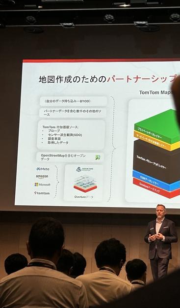
#OvertureMaps 、施設情報の「meta贔屓」をやめてOSM由来のデータをちゃんと突き合わせたほうが絶対品質が上がるのに
そうする気配がないのが本気で「良い地図」を提供したいのかわからないところ
もうすっかり存在を忘れかけていた #OvertureMaps のことを不意に思い出し坂戸市内をwatchしていたら
坂戸のまるひろの中にある焼き鳥店が存在することになっていたのをお知らせします(実際はまるひろごと解体され跡地にコープが開業している)
How to Use Overture Maps Like OSMnx — by City2Graph

City2Graph brings Overture Maps to spatial network analysis

Medium
@heiseonline Na dann vergleichen wir doch mal mit #OpenStreetMap und #OvertureMaps
(Also ich nicht, fahre gerade ICE)
#TomTom, Microsoft, Meta (Facebook), Amazon, & others are sharing mapping data as Open Source data in the #OvertureMaps Foundation. Collaboration through shared data sets to help make maps better and more accurate. #OvertureMaps (Note one mapping provider is not participating, #GoogleMaps). #TomTomDiscover
@geonews Do you know if #OvertureMaps #GERS ID are already entering in #OpenStreetMap data ? I would expect so, but I'm not sure what tag to search for. Taginfo counts 61 ref:gers entries, which I find remarkably low: https://taginfo.openstreetmap.org/keys/ref%3Agers.
ref:gers | Keys | OpenStreetMap Taginfo

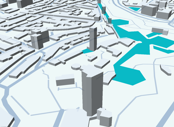
The #OvertureMaps also contain #OSM building parts now, as ready to use geometries. But not only, also geometries of AI sources are included. No roof shapes, but it may be interesting anyway to inspect their data. There is no Web API to get small regions. There is a #RustLang crate to read the GeoParquet format they use.

Do you use #Overture ? Do you know the URL to get the files? Could you provide a Rust code example? If yes, I would add it to the inputs of "OBI"

@simon @linuxfoundation Does that matter if the processed data is open? You have the choice of using the raw data from #osm or the processed data from #overturemaps which may include other sources as well
When #OvertureMaps announced a new dataset

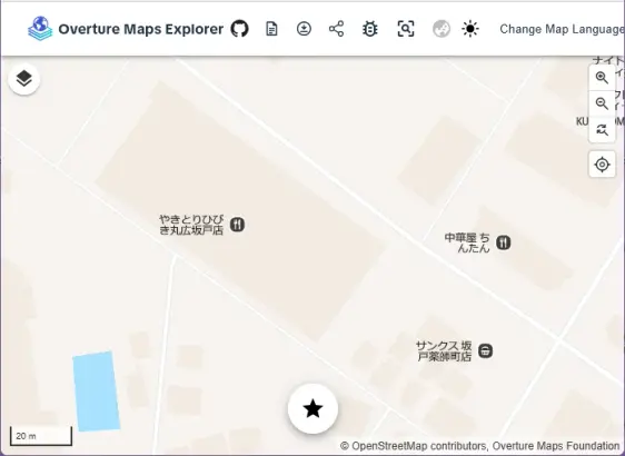
Pro tip for overturemaps building footprint downloads: While the official data download can be tricky, explore.overturemaps.org is a handy alternative (though limited to zoom 15). Need to check multiple areas? Here's a QGIS field calculator hack:

'https://explore.overturemaps.org/#15/' || to_string(y(centroid($geometry)), 5) || '/' || to_string(x(centroid($geometry)), 5)

This generates clickable URLs for each grid cell! 🗺️ #QGIS #OpenData #overturemaps

Overture Maps Explorer (Beta)