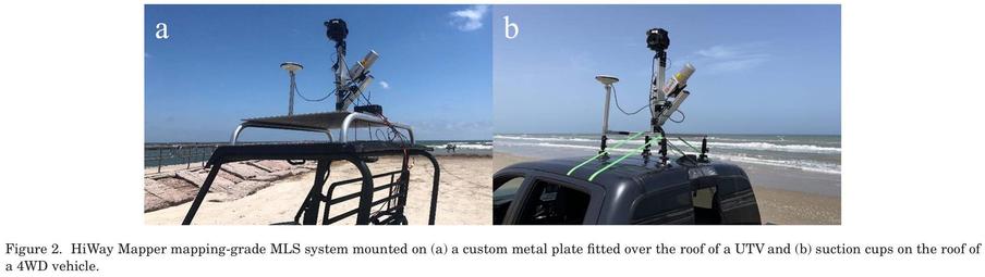
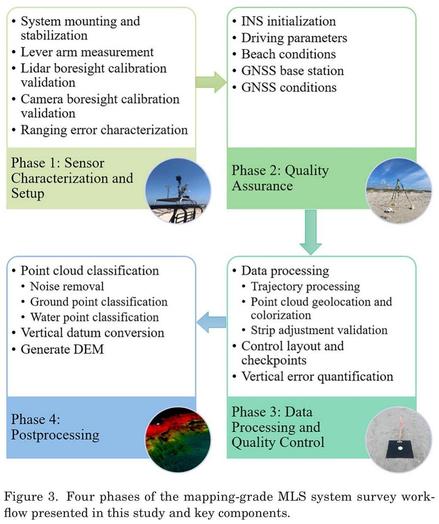
Development Of An Optimized Survey Workflow For Sandy Beaches With Mapping-Grade Mobile LIDAR
--
https://doi.org/10.2112/JCOASTRES-D-24-00056.1 <-- shared paper
--
#GIS #spatial #mapping #beach #sandy #coast #coastal #corridor #surveying #remotesensing #LiDAR #workflow #calibration #HiWayMapper #vehicle #UTV #4wd dataprocessing #postprocessing #GNSS #navigation #imagery #pointcloud #dunes #foredunes #geomorphology #geomorphometry #rmse #error #accuracy #precision #evaluation #metrics #shoreline #seasonal #dynamics #marine #waves #erosion #deposition
--
https://doi.org/10.2112/JCOASTRES-D-24-00056.1 <-- shared paper
--
#GIS #spatial #mapping #beach #sandy #coast #coastal #corridor #surveying #remotesensing #LiDAR #workflow #calibration #HiWayMapper #vehicle #UTV #4wd dataprocessing #postprocessing #GNSS #navigation #imagery #pointcloud #dunes #foredunes #geomorphology #geomorphometry #rmse #error #accuracy #precision #evaluation #metrics #shoreline #seasonal #dynamics #marine #waves #erosion #deposition