#openstreetmap #hauteprovence
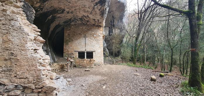
I am looking for a way to map rock shelters pretty common in Southern France. Seems there was a proposal to map this with natural:rock_overhang but that might be stuck somehow.... Especially in the cases in which you have buildings, tracks and trails going along below these overhangs it might become tricky. (I do not have found any meaningful instructions)
I am looking for a way to map rock shelters pretty common in Southern France. Seems there was a proposal to map this with natural:rock_overhang but that might be stuck somehow.... Especially in the cases in which you have buildings, tracks and trails going along below these overhangs it might become tricky. (I do not have found any meaningful instructions)