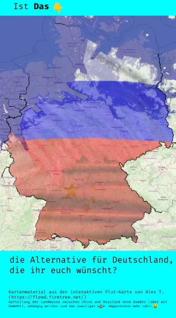
@pruefner Aus gegebenen Anlass hier noch mal die
#floodmap von
#fevertree mit dem Blick auf die
#Nordseeküste bei (nur) 1m Meeresspiegel Anstieg.
#klimakatastrophe #meeresspiegel #3GradHinweis: aus zeitlichen Gründen liefere ich eine ausführliche Bildbeschreibung im Laufe des Tages nach.
 YouTube
Dozens of Camp Mystic buildings removed from flood map in recent years, records show
Federal regulators repeatedly granted appeals to remove Camp Mystic’s buildings from their 100-year flood map, as the camp operated and expanded in a dangerous flood plain in the years before rushing waters swept away children and counselors. The Federal Emergency Management Agency included the prestigious camp for girls in a “Special Flood Hazard Area” in its National Flood Insurance map for Kerr County in 2011, which means it was required to have flood insurance and faced tighter regulation on any future construction projects. But in map amendments in 2013, 2019 and 2020, FEMA granted appeals to remove 30 Camp Mystic structures from the map. The amendments shielded buildings at the original site, as well as at a second camp site.
Before you continue to YouTube
How bad will flooding get by 2100? These AI images show US destinations underwater
Sea levels along the US coastline could rise as much as 12in from 2020 to 2050 due to climate crisis, scientists warn
@Hyades51 What is
#FloodMap? I had to use
#topoMap and follow contours, but this was early '70s IIRC.
The Ghost of long suppressed San Francisco streams reassert themselves.
#IslaisCreek #MissionCreek #SanFrancisco #Flooding #FloodMap #weather #Wx
