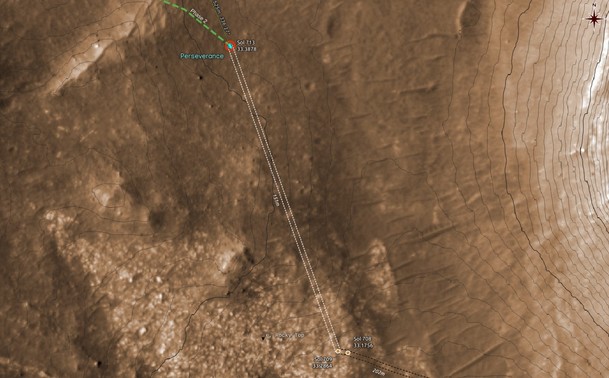
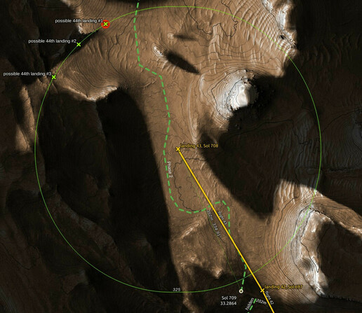
Ken Farley's presentation in #MEPAG39 showed a path along the east side of the foothills that lie to the west of the valley ahead of #Perseverance, but more interestingly it showed a mark for science activity around the place where #Ingenuity is currently located after its #Flight44.
The red mark shows the #MarsHelicopter's 44th landing, the green path is from the presentation. The background map is drawn in #QGIS with data from #HiRISE and #MMGIS