STORM DAVE: Coastal gales and danger to life warnings for Wales tonight — but 20°C sunshine on the way
Storm Dave is sweeping across Wales today, bringing gale-force winds, travel disruption and coastal danger warnings to the region — though forecasters are promising a dramatic turnaround before the week is out.
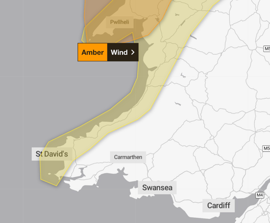
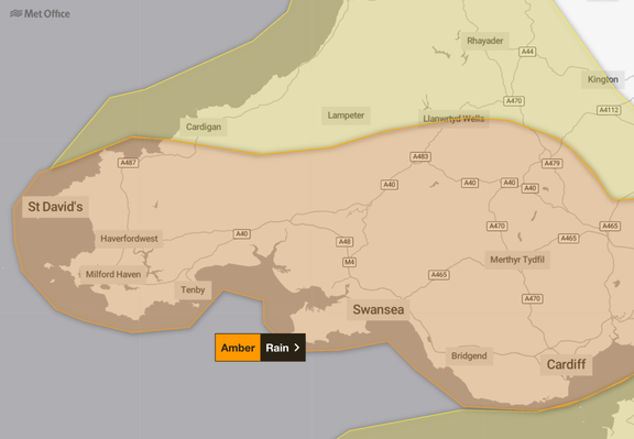
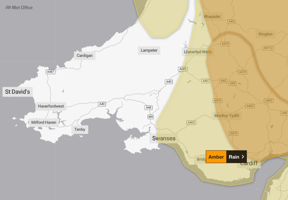
The Met Office has issued an amber wind warning covering north-west Wales from 7pm this evening until 3am on Easter Sunday, warning that gusts of 60-70mph are possible in some locations, with coastal and exposed spots potentially reaching 80mph. Injuries and danger to life from flying debris are among the risks cited, alongside the possibility of power cuts and significant travel disruption.
Met Office weather warnings for Win on Saturday 4 and Sunday 5 April 2026 as Storm Dave batters the coast.A series of yellow wind warnings are also in place across a broader area. Met Office chief meteorologist Chris Bulmer said people should be prepared for the impacts. “Storm Dave will bring a period of very strong winds, with the strongest gusts most likely in the amber warning area,” he said. “People should be prepared for impacts with disruption to travel likely and possible power cuts.”
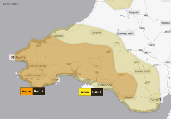
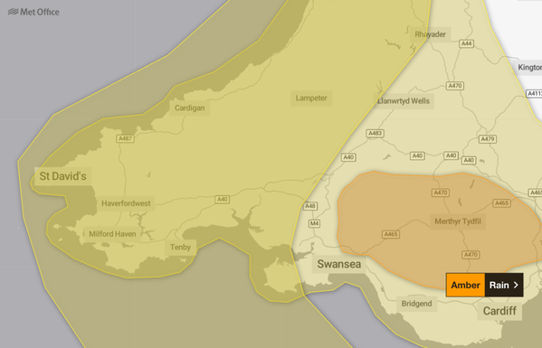
South and west Wales, while sitting south of the amber warning zone, will still feel the effects. The Met Office forecast for Swansea warns of gales developing from mid-afternoon today, with disruptive winds arriving this evening before gradually easing overnight. In Carmarthenshire, a cloudy and wet Saturday is expected to turn increasingly windy through the afternoon as Storm Dave arrives, with a maximum of 13°C.
Coastal communities across the patch face particular risks, with the Met Office warning that large waves could throw debris onto sea fronts, coastal roads and properties — a concern for areas along the Gower, Pembrokeshire and Carmarthen Bay coastlines.
Those travelling over the Easter weekend are being urged to plan ahead, with road, rail, air and ferry services all potentially affected. RAC spokesperson Rod Dennis said drivers should not underestimate the conditions. “We recommend taking extra care on exposed, higher routes and being especially cautious when overtaking high-sided vehicles, as the buffeting effect can catch some people out,” he said. “Slowing down and keeping a firm grip on the steering wheel are both vital in these conditions.”
Storm Dave is the second named storm of the year, following Storm Chandra which hit in late January. It is expected to sweep across the UK from west to east overnight before clearing into the North Sea on Sunday.
Easter Sunday should see a brighter picture for south Wales, with sunny spells and scattered showers but lighter winds. Easter Monday is forecast to be the driest day of the long weekend, with a ridge of high pressure bringing a more settled feel and sunny spells across the region.
The real reward, however, comes next week. A Met Office meteorologist said warmer air moving in from the continent through Tuesday and into Wednesday would push temperatures to the low 20s, with the possibility of 23°C or 24°C by midweek — well above the average for early April.
The latest warnings and local forecasts for Swansea, Carmarthen, Pembrokeshire and the surrounding area are available at the Met Office website.
Related stories from Swansea Bay News
Storm Chandra to hit South West Wales with severe winds and heavy rain
South West Wales braced for disruptive weather as Storm Chandra brought severe winds and heavy rain to the region.
Swansea escapes Storm Goretti snow — but Wales still hit by thundersnow, travel chaos and power cuts
Swansea, Llanelli, Neath and Port Talbot escaped the worst of Storm Goretti while other parts of Wales bore the brunt.
Storm Ingrid set to batter South West Wales with heavy rain, strong winds and flooding risk
Storm Ingrid brought heavy rain, strong winds and flooding risk to south west Wales.
‘It’s rained every day this year’: South Wales soaked as January hits 156% of normal rainfall
South Wales endured rain on every single day of 2026 so far, with January recording 156% of its normal rainfall.