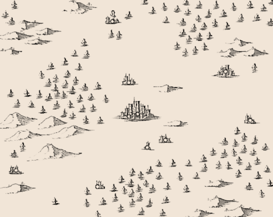
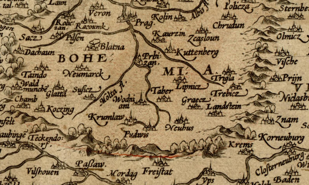
I extracted over 400 images of hills, trees, mountains, towns and cities for #ttrpg mapmaking and #gamedev from a 17th century map. I hope this is useful to someone. https://zarkonnen.itch.io/extracted-1688-map-images
@Zarkonnen very cool!
Tabula Peutingeriana, from the 5th century AD, would be a good candidate, it's full of city/town representations.
@Zarkonnen The Ferraris Map comes to mind
https://en.wikipedia.org/wiki/Ferraris_map
https://www.kbr.be/en/the-ferraris-map/
not sure if there is an easy to retrieve copy somewhere, but a lot of it is on wikimedia.
@Zarkonnen Very cool! Could you add the source of the 1688 map you used? Stuff like title, engraver, printer? (I know you have linked it, but copying the citation + DOI would be great.)
I think Merian's Topographia Germaniae might contain more interesting bits, but that would probably spread out over a bunch of various engravings. The work includes maps and panoramic views. Here's the Commons category: https://commons.wikimedia.org/wiki/Category:Topographia_Germaniae, most of the files are in subcategories. #Merian
@Zarkonnen do you remember the '80s PC game "Skis", where you skied down a slope until eventually got eaten up by a monster?
This.
⛷️🗻
Yay, thank you!
@Zarkonnen Very cool and exciting. This is going to distract me from work ... something to come back to. Yeah the Ferris map @jollysea suggested is a good one, otherwise the Theatrum Orbis Terrarum.
https://www.loc.gov/resource/g3200m.gct00003/?st=gallery&c=160
Or here, another copy of it:
https://www.loc.gov/resource/g3200m.gct00126/?sp=36&r=0.544,0.35,0.273,0.166,0
I don't know if these are out of copyright or not.
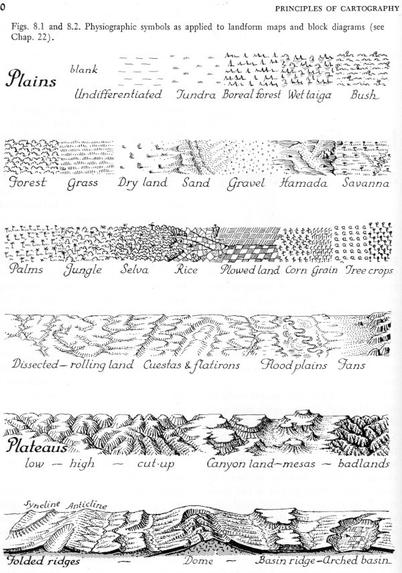
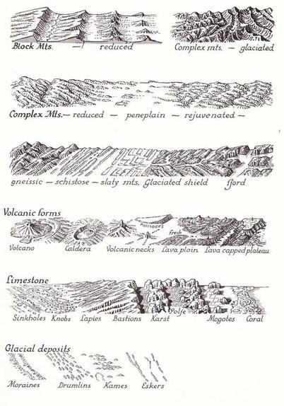
Principles of Cartography by Erwin Raisz, 1962