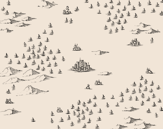
I extracted over 400 images of hills, trees, mountains, towns and cities for
#ttrpg mapmaking and
#gamedev from a 17th century map. I hope this is useful to someone.
https://zarkonnen.itch.io/extracted-1688-map-images
Extracted 1688 Map Images by Zarkonnen
Hand-drawn map assets
If you have other public domain maps with other kinds of interesting features you'd like me to process like this, let me know.
@Zarkonnen very cool!
Tabula Peutingeriana, from the 5th century AD, would be a good candidate, it's full of city/town representations.
https://archive.org/details/Tabula_Peutingeriana_complete/

Tabula Peutingeriana : Conradi Millieri : Free Download, Borrow, and Streaming : Internet Archive
TIFF file with a scan of the Tabula Peutingeriana, 1-4th century CE. Facsimile edition by Conradi Millieri, 1887/1888 Made collating images from:...