They let New Zealand and Hawaii design the view of earth for the official flag.

(But also I look at this a lot and think about my ambition to sail across it. Radar, satellite phone, all the tech or not... that is a lot of big angry water.)

(But also... can you really claim to know the earth if you don't know anything about all of this?)

Have you considered:
all of that water
is one big living object?
@futurebird Yes and that’s why it must be destroyed!

@mxtthxw

Picking a fight with the damn ocean: the *most* Homo sapiens thing ever.

@futurebird @mxtthxw Caligula's genius was unappreciated in his own time.

@mxtthxw

My brother in christ that is literally the biggest single thing on the earth.

@futurebird @mxtthxw The Big Wet controls the most surface area, and refuses to let us even walk upon it. We must not stand for this oppression!
@futurebird or the whole planet? The Galaxy? The universe???
@futurebird
It is the blood plasma of the living Earth, and we are all but the cells therein.
@maddiefuzz
@Blort @futurebird @maddiefuzz I came by that backwards, in high school, that with the salinity and pH of blood, we had carried the ocean up onto the land with us, like the division of circulatory systems at a birth.

@futurebird For Pasifika people this is the case: "for many Pacific Island peoples, the Ocean is a single living, moving, sacred entity and the bloodline of the people."

While most nations think of territories on land masses as home, for Pasifika the ocean is home as much as its islands are.

My family subsisted on the ocean's bounty; we worshipped gods and goddesses who were likewise the ocean (Nā-maka-o-Kahaʻi and Kanaloa) and of the ocean (Kamohoali’i and Ku'ula)
https://internationalfunders.org/security-briefs/indigenous-defenders-of-pacific-islands/#:~:text=The%20Oceanic%20world%20gave%20rise,ocean%20voyaging%20abilities%20and%20skills.

@futurebird Meant to add this wrt to "angry" ocean. The Pacific is rather calm in comparison to the Atlantic as you can see from the map below. Compare it to the Atlantic wave map at earth nullschool net: https://earth.nullschool.net/#current/ocean/primary/waves/overlay=significant_wave_height/orthographic=328.28,-0.68,177
earth :: a global map of wind, weather, and ocean conditions

See current wind, weather, ocean, and pollution conditions, as forecast by supercomputers, on an interactive animated map. Updated every three hours.

@futurebird If you want to freak people out about climate change, point out that a bucket of seawater removed from the ocean will start to smell _very_ strongly of dead fish after a few days, because seawater has half a million cells per milliliter in it which can't survive out of context:

https://www.ncbi.nlm.nih.gov/books/NBK224740/

Which means the ocean is something that can die. Not the fish or crabs or clams, not the seaweed. The water.

Diminutive Cells in the Oceans—Unanswered Questions

Edward F. DeLong

NCBI Bookshelf
@landley @futurebird
You have successfully freaked me out - about climate change (« we’re doomed, doomed ») and also about my sea-swimming. Is this why my ear gets so itchy…?

@AVO8OHM @futurebird Seawater and blood have a surprising amount in common.

Blood has about 10x as many cells per milliliter as seawater, meaning seawater has 1/10 the cell density of blood.

@futurebird and it's such a thin layer comparatively but so vast compared to our spaces... and we have managed to make it warmer...
@futurebird ... and R'lyeh is center-right, just as in USAian politics.

@futurebird it’s fascinating to think how the land and ocean ended up* so clustered on Earth’s surface

*not that we’re really at the end.. just the end of the past movement

@futurebird

Stuff looks ke that make you realize what astounding sailors the Maori were. They navigated all of that just off of stars and current patterns.

@jrconlin @futurebird
they also made heavy use of their knowledge of the habits marine animals, from seabirds to turtles to squid to sharks and on and on.
@futurebird my country is in there too! I’m in this pic 😁😋
@neurologo @futurebird in addition to all the water, having the North Pole on the left rather than on the top is very disorienting. It took me a minute to realize Mexico is in there, at the top.

@neurologo @futurebird I think I'm there too, just barely, at the top & at the left edge, judging by the shape of the coast north of Baja California. If not, I'm barely over the edge there.

The funny thing to me was how not-strange, how oddly familiar, this view of the earth became-& how quickly it did- once I saw what I was looking at.

@futurebird That some idiot conquistador named Panthallassia’s mighty daughter the “Pacific” ocean just goes to show what lengths History will go to punk us.
@futurebird
Threading is broken for me I think. Who /what official flag is this?

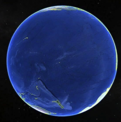
@futurebird now THIS is the default map view of earth that i like to see. it puts things into their proper perspective.

i don't know much about the ocean, but i know enough to respect it, be in awe of it, and understand that it's much more powerful than us humans.

the ocean is not just "sitting" out there. it never stands still. it's always churning churning churning.

there are worlds within worlds (down to the tiniest scales) in the ocean. there are ecological relationships & cycles down there that have been going for a very very long time, and if humans do something to break them, it'll be a very very VERY long time before relationships like that re-emerge (if ever).

and the ocean is not just sitting *out there*. we are in relation to it in many ways, from the weather it creates, to the fish it gives, and the hurricanes it hurls at us.

human health is interdependent with the health of the ocean. the oceans are a soup of life and if the ocean dies, so do humans.

anyway, aloha from hawai'i island, where we know that we are but a tiny speck surrounded by ~the ocean~! 🤙​🌞​🌧️​🌋​🌊​

@futurebird @quixoticgeek entirety of mexico being “scraps of coast” XD
@futurebird this is the default view of Earth the hyperintelligent squids living beneath the midnight zone use.
@futurebird Ah! A beautiful sea of islands! The great ocean connects them all.

@futurebird

From Alamogordo to Australia to Antarctica, it's an awesome angle of mostly agua, amiright?

@futurebird I've often thought about how little land is on that half of the Earth.
@futurebird You won’t understand a beach by counting the grains of sand.
@futurebird Check out SV Delos on youtube, they just sailed from Mexico to French Polynesia
@futurebird @lisamelton ha not bad, I can just see home on the edge 😉

@futurebird
I can (just) see my house from here! 😉
(Just to the left of Tasmania, bottom-left-ish of rim.)

Such a different perspective though. Love it.

@futurebird love it! what flag is this going on??
@futurebird Flying from Brisbane, Australia to L.A. is sobering. The flight I took in 2015 went over the Hawaiian islands, which I saw en route. I also saw other islands but I didn't know their shapes or names. The flight goes back in time, another sobering fact. Recommended.
@futurebird one of my students asked me today why the planet is called "earth" and not "water"
@futurebird A fascinating perspective that I've never visualized. Half the world and all water. Criminal that we're not treating it better.
Dymaxion map - Wikipedia

@futurebird Now that the maps we interact with every day are electronic, this really is pretty close to the main view of the world we get from New Zealand. It’s easy to forget how large other landmasses are.

I grew up with British Mercator maps, and I wonder how much cultural change is occurring as our collective memory of those fades.

@isaacfreeman @futurebird
I am reminded of a picture I've had stuck to my fridge for many years.