oh missed this - "WebODM has officially decoupled from OpenDroneMap"
Anybody likes to operate a mastodon account for #webodm ?
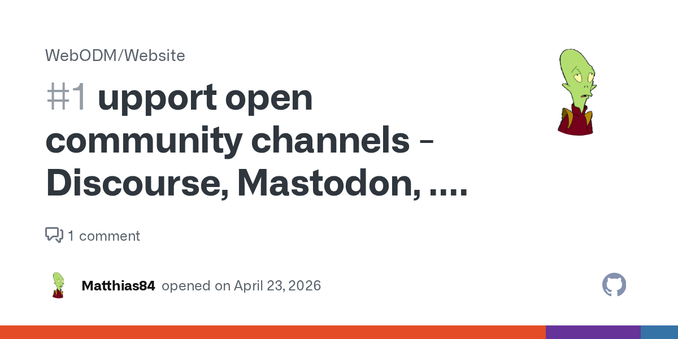
https://github.com/WebODM/Website/issues/1
# Wochenrückblick, Ausgabe 138 (2026-16)
Themen:
🚵♂️ Mit dem Rad in Berlin: Tempelhofer Feld und Mini-Rant über den VBB
💸 Wandrer wird 33 % teurer
📷 WebODM: Drone-Mapping-Software
🗺️ Bikerouter-Update: Route Manager
📺 Geschaut: „The Newsreader“
🔊 In dieser Woche gehört: Yves Deruyter, Christopher Lawrence, John 00 Fleming, Giuseppe Ottaviani, Markus Schulz
#Wochenrückblick #Berlin #EDDI #TempelhoferFeld #VBB #Wandrer #WebODM #Bikerouter #TheNewsreader #Techno

Rückblick Kalenderwoche 2026-16
🚵♂️ Mit dem Rad in Berlin: Tempelhofer Feld und Mini-Rant über den VBB 💸 Wandrer wird 33 % teurer 📷 WebODM: Drone-Mapping-Software 🗺️ Bikerouter-Update: Route Manager 📺 Geschaut: „The Newsreader“ 🔊 In dieser Woche gehört: Yves Deruyter, Christopher Lawrence, John 00 Fleming, Giuseppe Ottaviani, Markus Schulz

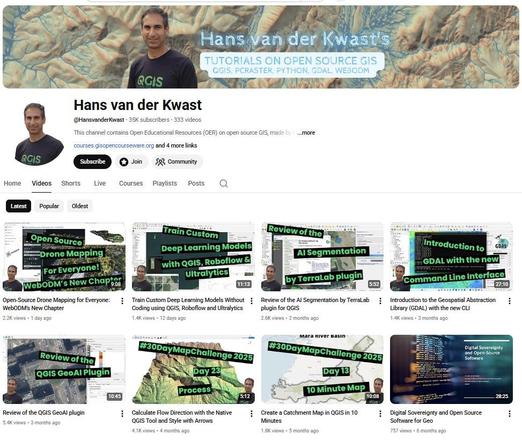
I just passed 35K subscribers on my YouTube channel and I'm grateful for everyone following my open‑source geo work.
But for those who prefer to avoid big tech: my videos are also published on #QwastTube, my own #PeerTube instance.
▶️ QwastTube: https://videos.qwast-gis.com/
▶️ YouTube (if you still use it): https://www.youtube.com/@HansvanderKwast
#FOSS4G #OpenSource #PeerTube #DigitalSovereignty #QGIS #GIS #WebODM #PCRaster #RemoteSensing
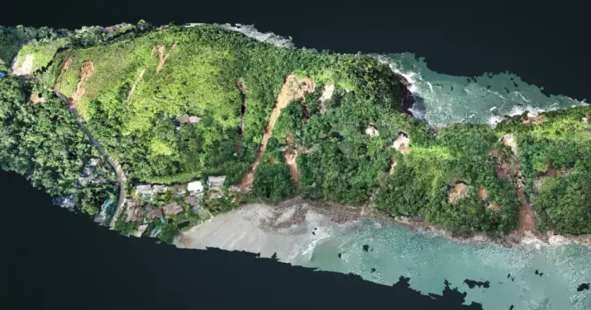
#WebODM has officially split from #OpenDroneMap.
I made a short video showing the full workflow from installation to 2D/3D visualisation.
🎥 Video: videos.qwast-gis.com/w/2KjiiJtEXE...
Official announcement from WebODM: webodm.org/blog/announc...
Open‑Source Drone Mapping for ...
Open‑Source Drone Mapping for ...
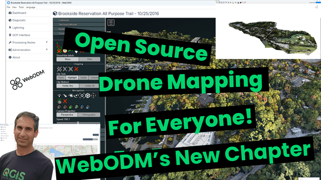
Open‑Source Drone Mapping for Everyone: WebODM’s New Chapter
#WebODM has officially split from #OpenDroneMap.
Official announcement from WebODM https://webodm.org/blog/announcement/
I made a short video showing the full workflow:
💻 Install WebODM with the new native installers
📸 import drone images
⚙️ process (orthomosaic, DSM, point cloud, 3D model)
🖼️ view in 2D/3D
⬇️ download results
🗺️ open in QGIS
If you want a user‑friendly, #opensource alternative to proprietary photogrammetry tools, WebODM is highly recommended.
🎥 Video: https://videos.qwast-gis.com/w/2KjiiJtEXEqz9qCSQnG5Ug
Open‑Source Drone Mapping for Everyone: WebODM’s New Chapter
Open‑Source Drone Mapping for Everyone: WebODM’s New Chapter
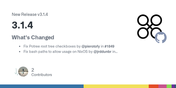
OpenDroneMap/WebODM
V3.1.4
---
- Fix Potree root tree checkboxes
- Fix bash paths to allow usage on NixOS
- Handle imperial units in task view
- Add ability to specify safe links in 3D view
- Media Support
---
OpenDroneMap/WebODM
V3.1.3
---
- Add snapshot plugin
- Add og tags on shareable views
- formulas: add BGRNReP and RGBNReP as used by the Micasense Rededge-P
- Import orthophotos, DEMs, point clouds from external sources
---
OpenDroneMap/WebODM
V3.1.2
---
- Improved DroneDB plugin
- Preserve XMP metadata when resizing images, 16bit and 32bit resize support, multithreaded processing
- Add pipeline option groups and enhance EditPresetDialog UI
---
