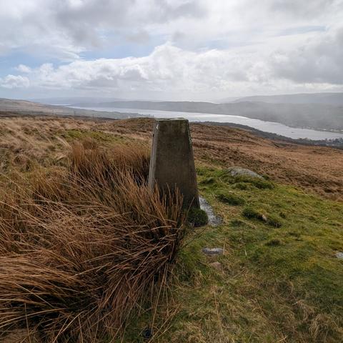
New Zealand Topographic Map - NZ Topo Map

New Zealand topographic map showing LINZ NZ Topo250 and NZ Topo50 map series. Features include: Both 1:250,000 / Topo250 and 1:50,000 / Topo50 map series; Placename, feature, map sheet and coordinate search; Printing map areas; Sharing and linking to locations; Coordinate conversion (NZTM, NZMG and WGS84); Ability to add kml and gpx (gps file format) overlays; Free Garmin Custom Map / Google Earth overlay downloads. Stewart Island and the Chatham Islands are also covered.

NZ Topo Map
Trig point above Ravenheugh Crags in #Northumberland from this afternoon. I'd walked from Stonehaugh, following the road and then a public byway... it was a little bit muddy!! 🀣 #TrigPoint #TrigBagging #Photography
5 trig points, 31km and nearly 1000m. Mostly lovely weather until the snow moved in. Got to cheer on the leaders in the #spinerace too… pics of them in next post. #ultrarunning #running #trigbagging #FellRunning
#OldManOfConiston #TrigPillar #TrigBagging #LakeDistrict #Hiking A very wet and windy climb on tricky terrain with 14 others
Busy day trig bagging in the Newcastle area 🀣 4 trigs bagged! One was in a private garden but I knocked on the door and was kindly taken through the garage to see it #TrigPillar #TrigBagging #TrigPoint
Bagged my 81st #TrigPillar today which means they fit nicely in a 9 x 9 layout. #TrigBagging
Today's trig for #trigpillartuesday is North Daren in the Black Mountains bagged in July 2016 with Dexter & Crosby #trigbagging #trigpillar
Just realised I missed #trigpillartuesday yesterday 😩 so here is a late entry Rhiw Arw in the Black Mountains bagged in July 2016 #trigbagging
Today's trig for #trigpillartuesday is Bal Mawr on the Black Mountains bagged in July 2016 #trigbagging