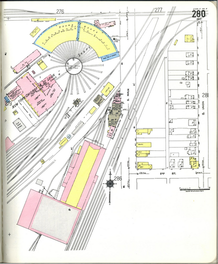
Man, this place has *everything*
#historicalMaps #OldMaps #SanbornMaps #ScotiaNY #LocalHistory
Man, this place has *everything*
#historicalMaps #OldMaps #SanbornMaps #ScotiaNY #LocalHistory
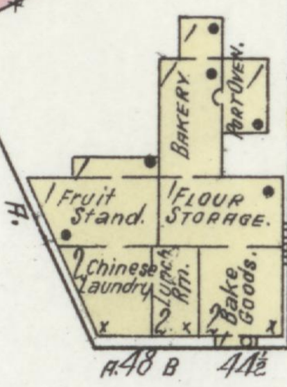
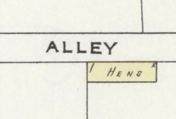
Okay, but can Waze tell you where the henhouses are? Don't think so.
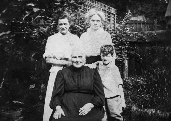
Neat! I just found the house where my twice-great grandmother Mary (Groh) Fischer lived in Pittsbugh. I think this photo is at a relative's house, but it's her, probably around 1915, so 80ish years old. The kid is my grandfather, and the other two women are his aunts.
Anyway I found her house in the 1906 #SanbornMaps (based on her census address). Modern maps say the house there today was built around then, so it's probably the same one she lived in!
Teaching About Community and Place with Library of Congress Maps – Teaching with the Library
Teaching with the Library Primary Sources & Ideas for Educators
ISSN 2691-6916, Share & Subscribe to this blog
Teaching About Community and Place with Library of Congress Maps
November 18, 2025, Posted by: Colleen Smith, Share this post…
Teaching the concept of community to elementary students often emphasizes a local community that students are members of, such as a school, neighborhood, town, or city. Maps from the Library’s collections offer teachers a range of tools for helping students see, think about, and form questions to develop a sense of place.
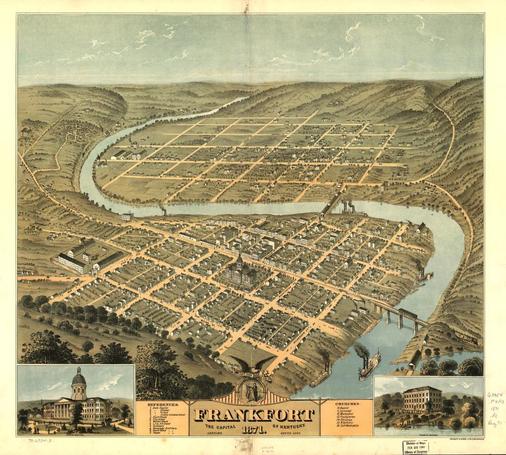
For example, in the primary source set, Community: People and Places, a panoramic map gives students a particular perspective of a city.
Sometimes referred to as “bird’s-eye views,” panoramic maps are great for helping students see different landscapes, street patterns, and prominent buildings. These engaging visual maps can be especially meaningful to young learners. Browse maps by state to locate panoramic maps closest to where your students live.
How teachers use panoramic maps will vary depending what aspect of community they want to explore; however, a few ideas might include:
The “Additional Resources” section of the Community: People and Places primary source set includes Sanborn Maps, another type of map that could be helpful for exploring different aspects of community and place.
The Sanborn map collection includes large-scale maps of commercial, industrial, and residential sections of thousands of cities and towns in the United States, Canada, and Mexico. The maps show the shape and construction of homes, commercial buildings, and factories as well as names of streets and property boundaries. You can search the collection by state and then by city or county. A fascinating use of the Sanborn maps is to explore change over time. This essay details several examples and might inspire ideas to modify for elementary-age students.
Detail from a series of Sanborn Maps of Santa Fe, New MexicoIf you are looking for maps that go beyond a local orientation of community, the Cities and Towns Collection features maps that detail places throughout the world. These maps might be helpful as students start to orient to community in a state, national, or even global context.
If you use maps from these collections with your students, we would love to hear about it! Please share your experiences and teaching recommendations in the comments.
Continue/Read Original Article Here: Teaching About Community and Place with Library of Congress Maps | Teaching with the Library
#community #frankfortMap1871 #issn26916916 #kentucky #libraryOfCongress #libraryOfCongressBlog #maps #newMexico #place #sanbornMaps #santaFe #teachingWithMaps
TFW you go to check the #SanbornMaps to confirm the location of an old building that doesn't exist anymore, and you discover that the Library of Congress has two more map books available for your town that weren't available last time you looked, and now you absolutely cannot continue with your original search until you've checked up on all your current pet theories and what new light these new maps shine on them.
Nothing like some 100+ year old insurance maps for organizing sightseeing plans.
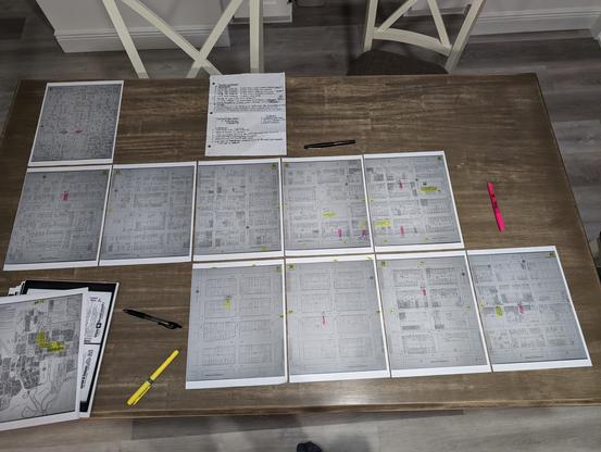
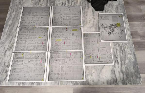
For those interested into looking into the #history of their local area, there's a great resource available in many areas. The #Sanborn Fire Insurance Maps provide very detailed maps of many #urban areas across the #usa. This includes many small towns and cities. Many of the older maps haven fallen into the #publicdomain and are available at Library of Congress and many other libraries.