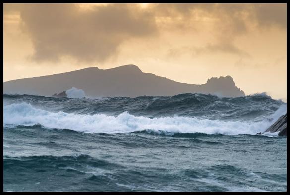
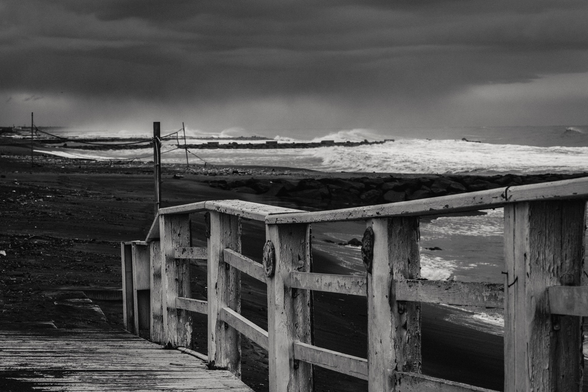
An Fear Marbh Through the Storm
On a calm day you can sit on Clogher Beach and see An Fear Marbh lying peacefully on the horizon, its profile supposedly resembling a body laid out in repose. On a day like this, though, you’re lucky to see it at all. The swell was stacking up in layers, each wave tall enough to swallow the base of the island entirely, leaving just the dark ridge floating above a wall of spray and foam.
That golden light breaking through the cloud behind it was almost unfairly cinematic, the kind of scene where you fire off a dozen frames and hope at least one captures what your eyes were actually seeing. The Dingle Peninsula has no shortage of dramatic viewpoints, but Clogher looking west towards the Blaskets in rough weather is hard to beat.
Apertureƒ/6.3CameraILCE-7RM5Focal length240mmISO400Shutter speed1/1000s #2026 #AnFearMarbh #AtlanticWaves #ClogherBeach #DinglePeninsula #Ireland #Kerry #Photo #Photography #roughSea #seascape #silhouette #SonyA7RV #WildAtlanticWay