Andes Ceque KML
New, public release, v2026.05.01
https://jqjacobs.net/kml/andes_ceque.kml
#GoogleEarth #KML #Placemarks
#Ancient #Monuments #Peru #Bolivia
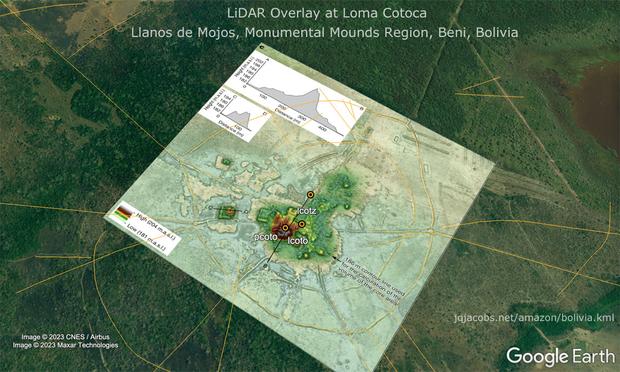
#Andes #Archaeology #Archaeogeodesy
#Apus #Arqueologia #Geodesia
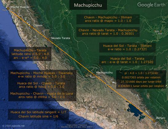
#Machupicchu #Tiwanaku #Chavin #Moche
New, public release, v2026.05.01
https://jqjacobs.net/kml/andes_ceque.kml
#GoogleEarth #KML #Placemarks
#Ancient #Monuments #Peru #Bolivia
#Andes #Archaeology #Archaeogeodesy
#Apus #Arqueologia #Geodesia
#Machupicchu #Tiwanaku #Chavin #Moche