La question du jour, bonjour,

#Question pour les fanas de #openstreetmap
je cherche un fond de carte blanc, minimaliste que je pourrais importer/utiliser dans un logiciel libre comme #GPXSee

Ça vous parle ? Vous savez faire ça ?

Merci.

#osm #gpx #ques

does anyone know why the profile differs from the GPS device compared to the gpx track log on the PC?

Here I'm looking at today's walk. On the GPS, at 3.38km I get the elevation of 363m. On the PC I get 431m.

The profile looks more correct on the GPS btw, I know I did that hill 3 times.
On the PC it looks like I did 4 "climbs".

#gps #gpx #garmin #gpxsee #viking #hiking

Pondering #Linux distros...

  • Arch-based
    • You're either doing the full Arch experience (good for you), or doing something Arch-based that's going to be unpredictably unstable and leave you with a non-booting system at some point in the future, and not having the technical understanding to fix it. Been burned by that already (twice!), hard pass.
  • Directly #Debian-based
    • I love Debian. I've loved it ever since a kind person at a Linux LUG burned me a copy of the Debian Potato 2.2 CD-ROMs in 2000. But an every-two-year release schedule is kind of hard to deal with given our current break-neck seat-of-your-pants development practices. Lots of compilers don't even want to work in Debian after midpoint or so in the release (1 year old), requiring things like rustup to be able to compile many tools.
  • Ubuntu-based
    • I'm going to skip over all of the meme-based criticisms of Ubuntu, and even the more technical criticisms of snap, which isn't that hard to eliminate. Simply put, from the things I've read, canonical sounds like a cult of personality, and gives me a bit of the heebie-jeebies. Other than that, ubuntu-based distros have the great benefit of actually decent user-focus and community support.
  • Fedora-based
    • #Fedora is adored by a lot of Linux enthusiasts, and has the benefit of a fairly large user-base, as well as being in the sweet-spot of having biannual updates. The only negative is the big lumbering evil shadow of IBM. I honestly don't know exactly what the relationship between Fedora and IBM (RedHat) is, but I'm fairly certain [it can't be said that there is none].

Umm... what exactly is left? Anything user-friendly? Well, perhaps...

  • OpenSuSE-based. (Yes, I'm using the old capitalization, because I'm crochety like that ;)
    • OpenSUSE Leap seems to have a release every year, which is pretty cool, but the new #OpenSUSE #SlowRoll seems like a really nice solution!
    • SUSE gives off a lot of "RedHat before they turned super evil" vibes, and I'm down with that
    • OpenSuSE also packages a lot of software for other distros. The debian package I'm using for #GPXSee, for example, is provided by https://packages.opensuse.org — that's super cool!

Hello fediverse, any advise/tips?

I record GPX tracks on a very ancient(!) gadget

I wish to create a PDF/JPG that shows a map with the track. Requirements:
- naming of places in Latin alphabet (eg for SE-Asia)
- decent amount of details
- format so that map/names are readable when viewed on screen or when printed A4
-no online service
- Linux only

The closest I get to this is with gpxsee, but no formatting, no Latin names!?

Appreciate any help!

#linux #gpx #gps #openstreetmap #gpxsee

J'ai retracé dans #Viking mon parcours d'hier, que j'ai ensuite exporté en GPX, puis ouvert dans #GPXSee pour voir la courbe altitude/distance… Tu m'étonne que c'est une ville hostile aux piétons et aux cyclistes…

Vu les détours que j'ai du faire pour me rendre à plusieurs endroits, la distance totale est un peu plus grande que ce à quoi je m’attendais.

Après, on n'est pas au mètre près… ça depend de la précision du tracé, mais c'est aussi vrai pour un tracé auto obtenu avec un récepteur GNSS…

@ericbuijs @pocketvj I noticed that the maps on my #Garmin Edge 530 were dated 2019, and the Garmin Connect Android app didn't offer to update them (I updated the firmware through it). I bit the bullet, as I currently have a Windows PC at home (employer owned CAD workstation), so tonight I installed Garmin Express and updated the maps. I find it silly to not be able to do it with the mobile app.

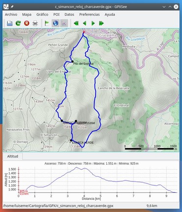
My Edge saves routes in FIT format. I found #GPXsee, an open source Linux map viewer that can import gpx and FIT files (and a few others). Unfortunately it cannot export them to gpx. But I found a Python library that apparently does, I'll test it out soon.

Garmin Express has been known to install successfully on Linux with Wine, although the latest entry on the WineHQ db reported failure. Somerhing to look into in the long run. Worst case is I keep the device as is.
#GPXSee es un visor y analizador de archivos de #GPS, desarrollado en #Qt, altamente configurable y que soporta todos los formatos comunes de archivos de registro de GPS.
https://www.gpxsee.org/index.html
GPXSee - GPS log file viewer and analyzer