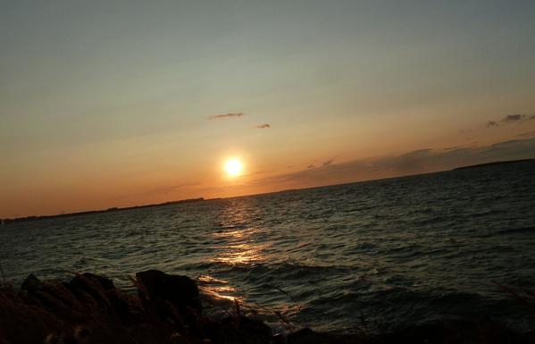
Guten Morgen allerseits! 😀 👋

Zum #MeerMittwoch heute eine weiter Blick vom Tafelberg auf den Südatlantik vor Kapstadt. Der Berg links in Form einer Haiflosse ist der Lions Head, der Bergrücken mit dem Stadion zu Füßen der Signal Hill und die Insel ist Robben Island, wo Nelson Mandela inhaftiert war.

#southafrica #capetown #atlantic #ocean #meer #landscape #landschaft #natur #nature #naturephotography #fotografie #photography #Photographie #foto #landscapephotography #travel #travelphotography

The Atlantic in Global History 1500-2000 by Jorge Canizares-Esguerra, Erik R Seeman, 2017

The Atlantic in Global History is a collection of original essays by leading authors that both introduce the main themes of Atlantic history and expand the category of the Atlantic chronologically, spatially, and methodologically.

@bookstodon
#books
#nonfiction
#history
#Atlantic

Heute Abend sind wir in der kleinen Stadt Contis Les Bains angekommen. Die Stimmung scheint hier lebendig und fröhlich zu sein. Sieht selbst. Und morgen gehen wir an den Strand 🏖️. Die Wellen hier sollen ziemlich hoch sein 🌊.

#travel #photography #france #frankreis #womo #atlantic #atlantik

#SevereWeather #TropicalDiscussion #Atlantic

Tropical Weather Outlook
NWS NHC Miami FL
200 AM EDT Tue Aug 19 2025

For the North Atlantic: Caribbean Sea & the Gulf of America:

Active Systems: The National Hurricane Center is issuing advisories on Hurricane Erin, located a couple hundred miles to the NE of the SE Bahamas.

1. Near the Leeward Islands in the Tropical Atlantic:
A tropical wave located over the central tropical Atlantic continues to produce a broad area of disorganized showers & thunderstorms. Environmental conditions appear conducive for gradual development of this system, & a tropical depression could form toward the end of the week or weekend. This system should move W to WNW at about 20 mph across the central tropical Atlantic & approach the vicinity of the Leeward Islands on FRI.
Formation chance thru 48 hours: low, 10%.
Formation chance thru 7 days: medium, 60%.

2. Eastern Tropical Atlantic: A tropical wave located a few hundred miles to the SE of the Cabo Verde Islands continues to produce a concentrated area of
showers and thunderstorms. Environmental conditions appear generally favorable for additional development over the next couple of days as the system moves westward at around 15 mph. Towards the end of this week, this system could encounter a less favorable environment, limiting its development chances after that time.
* Formation chance thru 48 hours: low, 30%.
* Formation chance thru 7 days: low, 30%.

Forecaster Papin

#Erin #Hurricane #SevereWeather #Atlantic #NCwx

BULLETIN
Hurricane Erin Advisory # 30
NWS NHC Miami FL
500 PM EDT Mon Aug 18 2025

...TROPICAL STORM AND STORM SURGE WATCHES ISSUED FOR THE NORTH CAROLINA OUTER BANKS...

LOC: 24.0N 71.3W; ABOUT 695 MI/1120 KM SW OF BERMUDA; ABOUT 815 MI/1310 KM SSE OF CAPE HATTERAS NC.
MAX SUSTAINED WINDS: 140 MPH/220 KM/H
PRES MOVE: NW OR 310 DEGREES AT 10 MPH/17 KM/H
MIN CENTRAL PRES: 937 MB/27.67 INCHES

A Tropical Storm Watch has been issued from Beaufort Inlet to Duck, NC including Pamlico Sound

A Storm Surge Watch has been issued from Cape Lookout to Duck, NC.

WATCHES AND WARNINGS: Tropical Storm Warning for: Turks & Caicos Islands; SE Bahamas

A Storm Surge Watch is in effect for: Cape Lookout to Duck, NC

A Tropical Storm Watch is in effect for: Central Bahamas; Beaufort Inlet to Duck, NC including Pamlico Sound

DISCUSSION: At 500 PM EDT (2100 UTC), the center of Hurricane Erin was located near latitude 24.0 North, longitude 71.3 West. Erin is moving toward the NW near 10 mph (17 km/h). A turn to the north is expected on Tuesday. On the forecast track, the core of Erin is expected to pass to the east of the SE & central Bahamas today & tonight, & move between Bermuda & the east coast of the United States by the middle of the week.

Erin is an unusually large hurricane. Hurricane-force winds extend outward up to 80 miles (130 km) from the center and tropical-storm-force winds extend outward up to 230 miles (370 km)…

Die Dune du Pilat bei #Arcachon in Frankreich. Sie ist ca. 110 Meter hoch, 500 Meter breit, etwa 2,7 Kilometer lang. Sie bewegt sich mit ca. 40cm pro Jahr und verschlingt langsam östlich-liegenden Wald.

#travel #photography #france #frankreich #atlantic #atlantik #dunedupilat #womo

#SevereWeather #TropicalDiscussion #Atlantic

Tropical Weather Outlook
NWS National Hurricane Center Miami FL
800 AM EDT Mon Aug 18 2025

For the North Atlantic...Caribbean Sea and the Gulf of America:

Active Systems: The National Hurricane Center is issuing advisories on Hurricane Erin, located a little over 100 miles north-northeast of Grand Turk
Island.

1. Tropical Atlantic: A tropical wave located over the eastern tropical Atlantic is producing disorganized showers and thunderstorms. Environmental conditions appear conducive for gradual development of this system, and a tropical depression could form during the latter part of the
week. This system should move westward to west-northwestward at about 20 mph across the central tropical Atlantic and approach the vicinity of the Leeward Islands toward the end of the week.
* Formation chance through 48 hours...low...near 0 percent.
* Formation chance through 7 days...medium...50 percent.

Forecaster Roberts

#Erin #Hurricane #SevereWeather #Atlantic

BULLETIN
Hurricane Erin Intermediate Advisory # 28A
NWS NHC Miami FL
800 AM EDT Mon Aug 18 2025

...LARGE AND POWERFUL HURRICANE ERIN LOCATED JUST EAST OF THE SOUTHEAST BAHAMAS...
...LIFE-THREATENING SURF AND RIP CURRENTS LIKELY ACROSS THE U.S. EASTERN SEABOARD THIS WEEK...

LOC: 23.1N 70.5W, ABOUT 115 MI/190 KM NNE OF GRAND TURK ISLAND; ABOUT 890 MI/1430 KM SSE OF CAPE HATTERAS NC
MAX SUSTAINED WINDS: 130 MPH/215 KM/H
PRES MOVE: NW OR 305 DEGREES AT 13 MPH/20 KM/H
MIN CENTRAL PRES: 933 MB/27.55 INCHES

WATCHES AND WARNINGS:

Tropical Storm Warning is in effect for: Turks and Caicos Islands, Southeast Bahamas

Tropical Storm Watch is in effect for: Central Bahamas

Interests in the NW Bahamas, the NC Outer Banks, and Bermuda should monitor the progress of Erin.

DISCUSSION: At 800 AM EDT (1200 UTC), the center of Hurricane Erin was located near latitude 23.1 North, longitude 70.5 West. Erin is moving toward the northwest near 13 mph (20 km/h). A gradual turn to the north is expected later today & on TUE. On the forecast track, the core of Erin is expected to pass to the east of the SE Bahamas today & move between Bermuda & the east coast of the United States by the middle of the week.

Maximum sustained winds are near 130 mph (215 km/h) with higher gusts. Erin is a category 4 hurricane on the Saffir-Simpson Hurricane Wind Scale. Some additional strengthening is expected
today…

https://www.nhc.noaa.gov/

Remember Hurricane Erin? Yeah, hitting Puerto Rico and Virgin Islands, as a Cat3, slatted to grow back to Cat4 borderline Cat5, right before it hits Bermudas??

Remember where and how it was born?

ABOUT THAT....

#Weather #Atlantic #Caribbean #Erin #TD2