Exploring the power of computer vision in Miami? Discover how it can streamline your business operations and enhance efficiency.
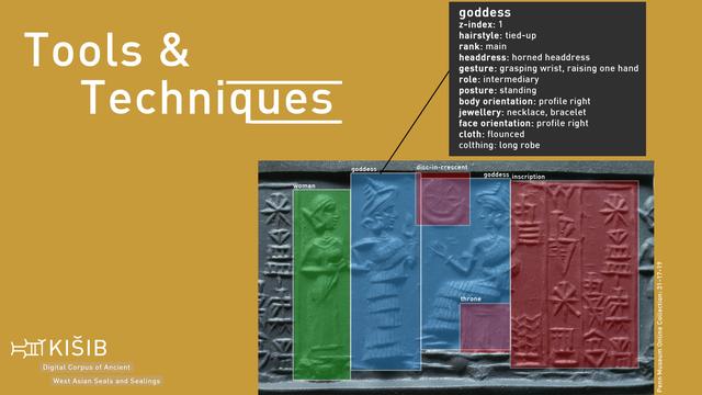
Computer vision converts visual data into actionable insights, reducing errors and boosting productivity. It's a game-changer for industries relying on precise visual analysis.
https://codeponents.com/?page_id=5472
#ComputerVision #MiamiTech #BusinessEfficiency #VisualData
Computer vision converts visual data into actionable insights, reducing errors and boosting productivity. It's a game-changer for industries relying on precise visual analysis.
https://codeponents.com/?page_id=5472
#ComputerVision #MiamiTech #BusinessEfficiency #VisualData