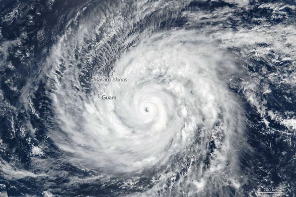
Il Fatto Quotidiano: Arriva il Super Tifone Sinlaku: nel Pacifico venti da 290 km/h. Si è trasformato in un “mostro atmosferico”
Nel Pacifico Settentrionale è in arrivo il Super Tifone Sinlaku. L’evento atmosferico, già classificato come la tempesta più violenta registrata da inizio anno, sta per abbattersi verso i territori statunitensi d’oltre mare con venti che sfiorano i 290 km/h. Equivale a un uragano di categoria 5 e per i meteorologi è uno dei più potenti e precoci mai registrati. Nelle Isole Marianne Settentrionali c’è già un blackout diffuso e le raffiche hanno sradicato diversi alberi.
All’inizio sembrava una semplice tempesta tropicale ma in meno di 36 ore si è trasformato in un “mostro atmosferico”. A causarlo sono state le temperature alte della superficie oceanica e una scarsa resistenza dei venti in quota. I più minacciati al momento dalla furia di Sinlaku sono gli atolli di Guam, Saipan e Tinian dove le autorità locali si sono già mosse per proteggere i circa 50mila abitanti. Piogge torrenziali e raffiche di vento intense sono già arrivate sulle Isole Guam, dove però l’occhio della tempesta non passerà direttamente. L’impatto pieno sarà sulle isole di Saipan, Tinian e Rota.
È il secondo ciclone di categoria 5 del 2026, dopo il passaggio di Horacio nell’Oceano Indiano a febbraio. Gli esperti della Nasa hanno spiegato che “Sinlaku è uno dei pochi tifoni di categoria 5 conosciuti per essersi verificati così presto nell’anno”, portando alla luce un trend di tempeste sempre più precoci e violente nel Pacifico nord-occidentale. Questo gigante atmosferico non è solo una minaccia immediata ma mostra una situazione climatica globale in mutamento costante dove il calore oceanico accumulato agisce come un serbatoio di combustibile quasi inesauribile per i cicloni tropicali.
L'articolo Arriva il Super Tifone Sinlaku: nel Pacifico venti da 290 km/h. Si è trasformato in un “mostro atmosferico” proviene da Il Fatto Quotidiano.
The Super Typhoon Sinlaku is arriving: winds of 290 km/h in the Pacific. It has transformed into an “atmospheric monster.”
A super typhoon, Sinlaku, is approaching the North Pacific. The weather event, already classified as the most violent storm recorded since the beginning of the year, is about to strike the United States territories with winds approaching 190 mph. It is equivalent to a Category 5 hurricane and for meteorologists it is one of the most powerful and early ones ever recorded. In the Northern Mariana Islands, there is already a widespread blackout and gusts of wind have uprooted several trees.
Initially, it seemed like a simple tropical storm, but in less than 36 hours it transformed into an “atmospheric monster.” It was caused by high ocean surface temperatures and a weak resistance of the winds at high altitudes. At the moment, the most threatened atolls are those of Guam, Saipan and Tinian, where local authorities have already moved to protect the approximately 50,000 residents. Torrential rains and intense wind gusts have already arrived on the island of Guam, where however the eye of the storm will not pass directly. The full impact will be on the islands of Saipan, Tinian and Rota.
It is the second Category 5 cyclone of 2026, after the passage of Horacio in the Indian Ocean in February. Nasa experts explained that “Sinlaku is one of the few Category 5 typhoons known to have occurred so early in the year,” highlighting a trend of increasingly early and violent storms in the northwest Pacific. This atmospheric giant is not only an immediate threat but shows a changing global climate situation where accumulated ocean heat acts as an inexhaustible fuel tank for tropical cyclones.
The article “Arriva il Super Tifone Sinlaku: nel Pacifico venti da 290 km/h. Si è trasformato in un “mostro atmosferico”” comes from Il Fatto Quotidiano.
#SuperTyphoonSinlaku #290km #Pacific #Sinlaku #theNorthPacific #theUnitedStates #190mph #Saipan #Tinian #second #Horacio #theIndianOcean #Category5 #ArrivailSuper #TifoneSinlaku #Pacifico #IlFattoQuotidiano
https://www.ilfattoquotidiano.it/2026/04/15/super-tifone-sinlaku-pacifico-venti-290kmh-notizie/8356195/
 Afghanistan 🇦🇫
 M
M
 Minoru Saba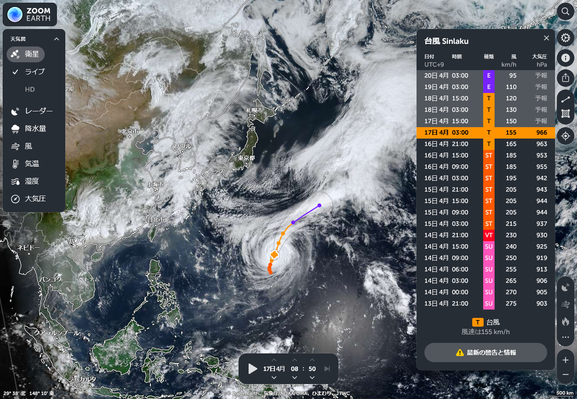
 AI6YR Ben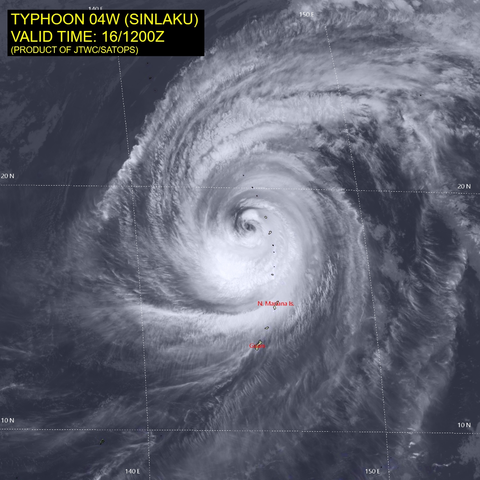
 Extrême Météo
 Union City, CA Weather
 gclef
gclef
 O=C=O
O=C=O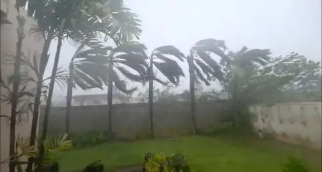
 Italian News by RSS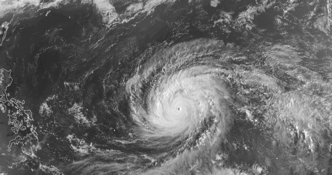
 Tutiempo.net