🔥 A major fuel break project west of Ukiah is expanding, as Mendocino Redwood Company and the Mendocino County Fire Safe Council work to thin forests and improve escape routes.
#mendocinocounty #mendocino #ukiah #california #readyforwildfire
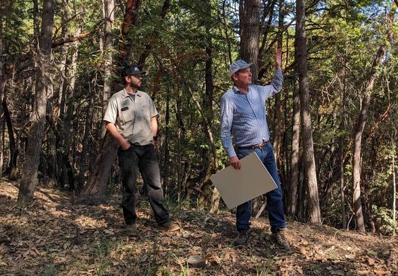
🔥 A major fuel break project west of Ukiah is expanding, as Mendocino Redwood Company and the Mendocino County Fire Safe Council work to thin forests and improve escape routes.
#mendocinocounty #mendocino #ukiah #california #readyforwildfire
RED FLAG WARNING,
FROM 11 AM TUES MORN (11/5) THRU THURS MORN (11/7)
Gusts up to 50 mph across higher elevations with relative humidity (RH) recoveries in the 30-45% range Tuesday night. Winds decrease thru the day Wed, but with the RH drops to the high teens. Fire weather conditions remain critical through Wed night.
WHERE: #SanFrancisco Bay Area & Central CA Coast, #California:
#SanFrancisco, #Marin Coastal Range, #Sonoma Coastal Range, #NorthBay Interior Mountains & Interior Valleys,
SF Bay Shoreline & Peninsula Coast, #EastBay Interior Valleys, #SantaCruz Mountains, #SantaClara Valley Including #SanJose, Eastern #SantaClara Hills, #EastBay Hills, #SantaLucia Mountains & #LosPadres National Forest, Mountains of #SanBenito County & Interior #Monterey County, #Pinnacles National Park, Northern Monterey Bay
#ReadyforWildfire #FireWx #FireWeather #CaliforniaWeather #CAwx #NorCalWx #SFBay #RedFlagWarning
RED FLAG WARNING,
FROM 11 AM TUESDAY MORN (11/5) THRU
THURSDAY MORN (11/7)
WHERE: #SanFrancisco Bay Area & Central CA Coast, #California
WHAT: Strong offshore winds and critically dry conditions. Gusts up to 50 mph across the higher elevations with RH recoveries in the 30-45% range Tuesday night. Winds decrease thru the day Wed, but with the RH dropping into the high teens. Fire weather conditions remain critical through Wed night.
#ReadyforWildfire #FireWx #FireWeather #CaliforniaWeather #CAwx #NorCalWx #SFBay
CALFIRE: Research suggests that creating a noncombustible buffer of five feet around your home can significantly improve the likelihood that it survives a wildfire. Creating a combustible-free Zone 0 that extends a minimum of five feet from each structure or, if applicable, an attached deck reduces the chance of wind-blown embers or radiant heat spreading the fire to your home. Remove bark and replace wood fencing and other potential fuel for sparks with noncombustible alternatives.
Learn more about creating defensible space and preparing for wildfire at: http://ReadyforWildfire.org

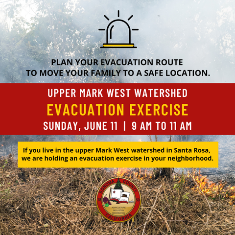
🚨 "An evacuation exercise is planned for the upper Mark West Springs watershed community this Sunday, June 11 at 9 a.m.; a preparedness resource fair will follow from 10-11 a.m. Register and learn more at https://socoemergency.org/get-ready/events-exercises/ "
Reposted from the County of Sonoma's Twitter. #SonomaCounty #SantaRosaCA #ReadyForWildfire