New article: High fire danger for Eastern Washington and Eastern Oregon Wednesday
ingallswx.com/2025/08/13/h...
#WAwx #WAfire #ORwx #ORfire
High fire danger for Eastern W...
High fire danger for Eastern W...
New article: High fire danger for Eastern Washington and Eastern Oregon Wednesday
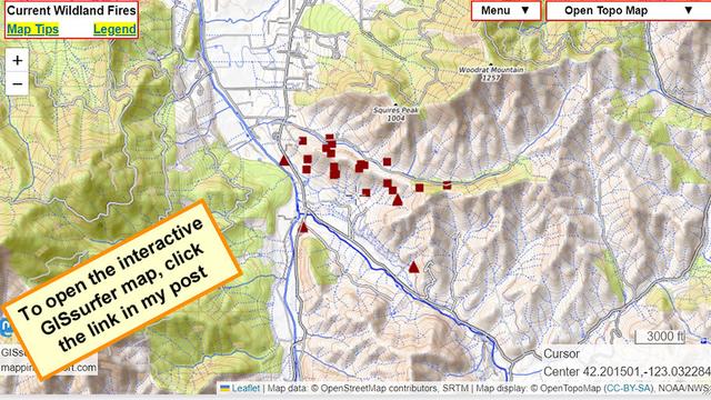
#UpperApplegateFire SW of Medford, Oregon
Never ignore an order to evacuate. The fire officials have information that you do not.
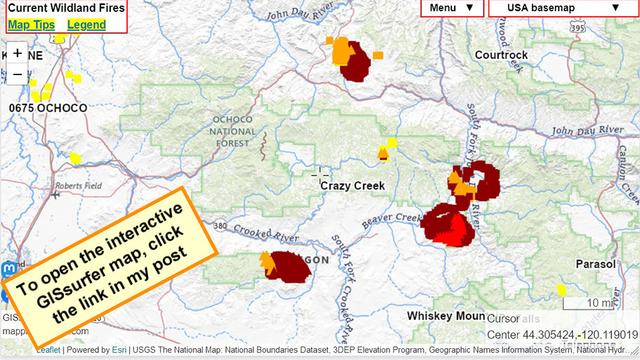
The symbols on the map are heat detections from MODIS and VIIRS satellites. This data is *not* real time and locations are approximate. Sometimes this data is ‘false positive’.
This data updates several times during the day. To read more about this kind of data, open the map and click “Map tips” in the upper left corner.
#ORfire #ORwx #Wildfire
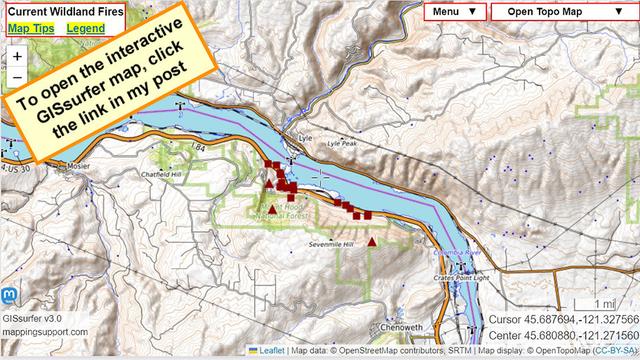
#RowenaFire in Columbia River George
I-84 in Oregon apparently still closed.
Never ignore an order to evacuate. The fire officials have information that you do not.
The symbols on the map are heat detections from MODIS and VIIRS satellites. This data is *not* real time and locations are approximate. Sometimes this data is ‘false positive’.
This data updates several times during the day. To read more about this kind of data, open the map and click “Map tips” in the upper left corner.
#ORfire #ORwx #Wildfire #PNW
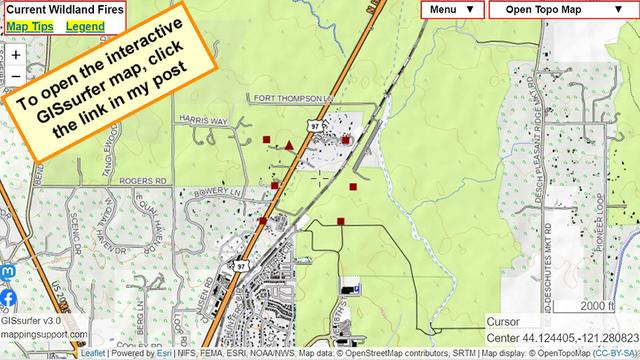
#MileMarker132Fire at north side of Bend Oregon.
Dark red symbols are heat detections by MODIS and VIIRS satellites sometime within prior 6 hours. Each location for a symbol is only approximate. For more details to help you understand what this data shows and does not show, please read the “Map tips” link in upper left corner of the map.
Never rely on any map or anything else you see online to ignore an order to evacuate. The fire officials have information that you do not.
#ORfire #ORwx
NBC: Air tanker plane goes missing while fighting Oregon wildfire
"...the plane went missing shortly before 7 p.m. Thursday night and there was one pilot on board. The Oregon National Guard was deployed to assist in the search..."
Excessive heat warning, red flag warning, and flash flood watch all at the same time in parts of Eastern Oregon.
T-storms are forecast to develop this afternoon. Some will be dry t-storms and create new fires. Others may be quite moist and there is a strong risk of debris flows coming off this year's huge burn scars.