https://youtu.be/pdDXf0dJm5Y?si=qdzeW8eLzMwEaHvE
#nwsspc boffins are becoming agitated.
Ryan Hall has joined them. Dismal Dominion will be in the barrel Sunday.
#vawx
Weather VLOG 3/11/2025: Weekend severe weather risks.

YouTube
Here’s Monday’s #NWSSPC severe weather forecast guidance for severe thunderstorm likelihood. Alabama, Louisiana, and Mississippi are at risk.

Dismal Wizard managed to notice sunrise and took actual sunrise photos of the smoky peach eastern sky and first light on the pines just west of the manor.

Furious discussion is underway to determine if these are fair or foul weather omens with regard to Tuesdays #NWSSPC and #NWSWPC predictions.

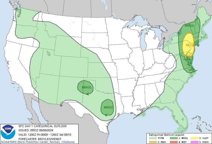
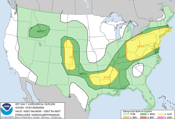
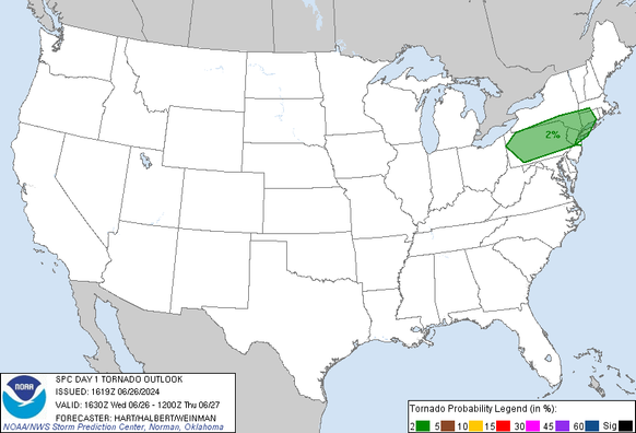
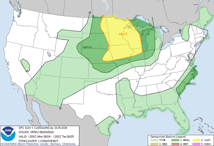
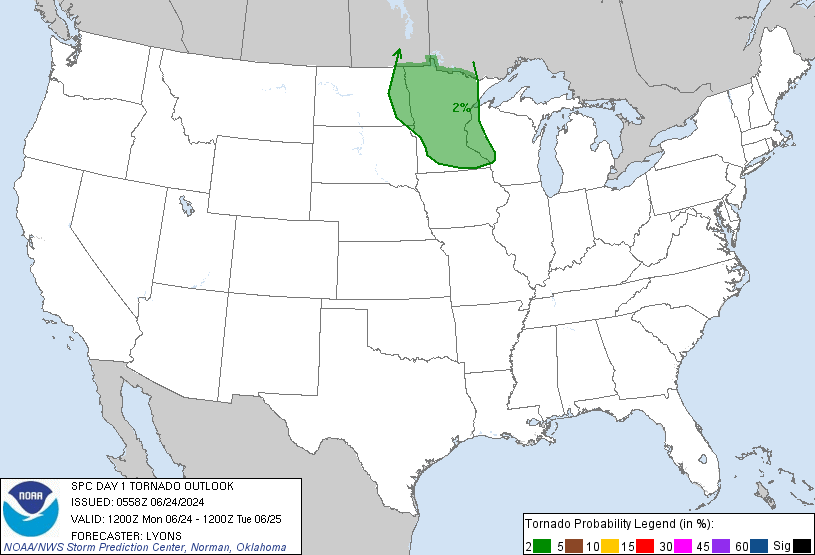
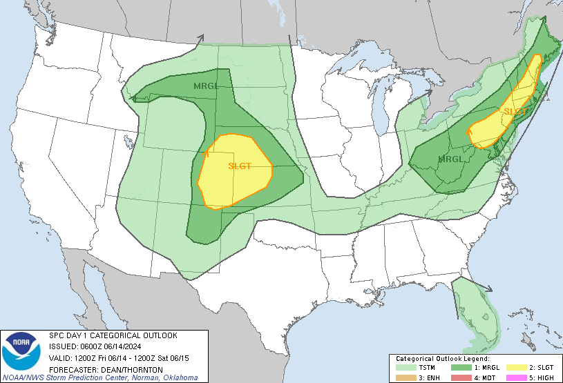
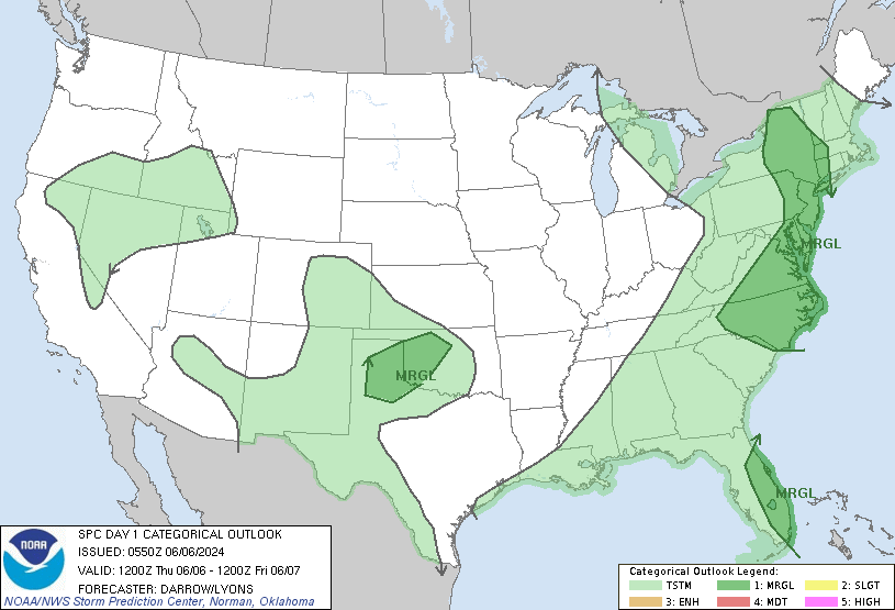
First image is the #NWSSPC severe thunderstorm forecast. A patch from Washington DC to lower Hudson River Valley have conditions favorable to tornadoes.

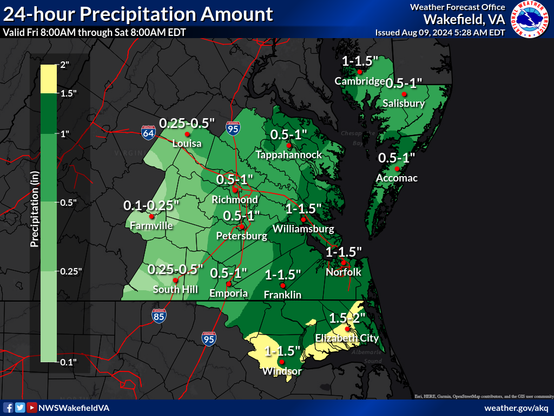
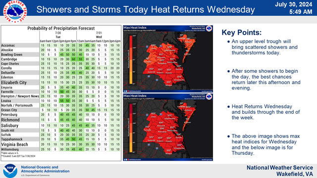
The rainfall estimate map shows another inch or so 25mm likely. The radar image from the local radar shows thunderstorms approaching from out south.

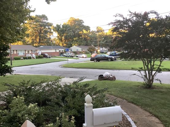
Since our bins are not too full, we are observing a virtual wheelie bin advisory.

Rain just began. Thursday brought 30 mm.

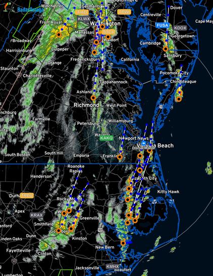
Tornado warning for Isle of Wight to Smithfield— tornado “radar indicated”. Local TV weather people in tornado mode. Radar has seen a shear couplet indicating rotation. No debris signature or visual confirmation.

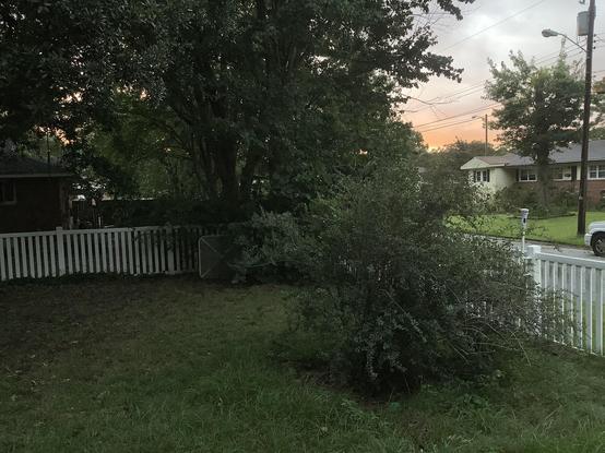
Dismal Manor is 20 miles to the east of track.

Ahoy all. Those “we’ll just mosey on over”thunderstorms packed some attitude. Though not severe, they took a limb off the pecan and dropped 10 mm rain instantly.

Weather boffins foresee Wednesday a rerun with heat building to unhealthy level and afternoon thunderstorms with severe storms possible from the upper #MS valley into #NC and #VA

#nwsspc severe weather guidance for Wednesday has the appearance of a malovelent weather Duck menacing the Great Plains and lesser prairie. Scattered thunderstorms in Appalachian Mountains and eastern low country — all of it and offshore waters. Rip currents possible on ocean beaches.

#Greyhounds slept until dawn. Up and fed.

DW booked for out patient endo and is whimpering pathetically as he contemplates the bill.

#today #severewx #vawx #ncwx

Just took a visit to weather.gov. Something weird is going on. iPad versions are not loading of any of the weather service sites. Meanwhile the full site loads fine in chrome-based ARC.

#nwsspc has updated the thunderstorm advisory for Wednesday to include all of #CTwx, #MAwx, #RIwx. The earlier advisory extended to Brooklyn NY (western end of Long Island).

The big surprise is that the tornado advisory has been expanded to cover all of southern New England: CT, MA, RI.

#nwsspc severe thunderstorm likely in the northern Great Plains, deep southeastern states, and Atlantic coast from Norfolk and south.

Conditions for tornado development are expected in Minnesota. #severewx #VAwx #NCwx

Today’s forecast is for a warm day with isolated to scattered thunderstorms in Dismal Dominion.

Our weather hazard bingo card reflects forecast and #nwsspc severe weather outlook showing most of the AOR in the shake, rattle, and roll advised area. Tornado conditions in only a patch in the western Great Plains.

Weatherflow timing is 1/20 probability after midnight. Hence the “isolated” evaluation. #vawx #severewx

Southern #flwx monsoon continues.

Dismal Manor Gang is waking up for loo and brekkie at 0500 as gray hour begins. Waffle Wednesday finds our severe weather bingo card clear again. The #nwsspc national severe weather forecast guidance shows severe weather probability in the western Great Plains with #mnwx having the greatest probability of damaging severe weather and tornadoes.

#NWSWakefieldVA advises a seasonable but pleasant day for Dismal Dominion.

Wednesday weather was exciting to our north with tornadoes on the ground in DC Metro region, Baltimore Metro region, and other random bits of #VA, #MD, #PA

Thursday morning, #nwsspc guidance does not anticipate tornadoes but #severewx is possible in the green and #NWSWakefieldVA advises caution.