#DLH #MNwx 276
WWUS83 KDLH 311510
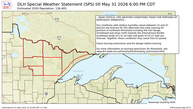
SPSDLH
Special Weather Statement
National Weather Service Duluth MN
1010 AM CDT Sun May 31 2026
MNZ010>012-018-019-026-312300-
Koochiching-North St. Louis-Northern Cook and Lake-North Itasca-
Central St. Louis-South Itasca-
Including the cities of International Falls, Ely, Isabella,
Bigfork, Hibbing, and Grand Rapids
1010 AM CDT Sun May 31 2026
...NEAR CRITICAL FIRE WEATHER CONDITIONS TODAY FOR PORTIONS OF
NORTHEAST MINNESOTA...
https://mesonet.agron.iastate.edu/p.php?pid=202605311510-KDLH-WWUS83-SPSDLH