May 2026 newsletter is here!
https://maplibre.org/news/2026-06-03-maplibre-newsletter-may-2026/
May 2026 newsletter is here!
https://maplibre.org/news/2026-06-03-maplibre-newsletter-may-2026/
Maps are infrastructure too.
At a recent Internet Archive Europe workshop, we explored how OpenStreetMap and MapLibre are building open, community-governed alternatives to proprietary mapping platforms.
Who decides what stays visible, preserved, and accessible?
https://www.internetarchive.eu/2026/06/08/maps-are-infrastructure-too/
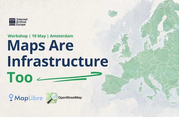
Not all infrastructure looks like a server room. Some of it looks like a map. On 19 May, Internet Archive Europe hosted a workshop at our Amsterdam space with Bart Louwers, one of the core maintainers of MapLibre, and Tommi Marmo, OpenStreetMap contributor. The conversation moved between the technical and the political in a way
Continuing our popular docs series with the Map Style Library.
8 styles to pick from: Alidade Smooth for data-heavy maps, Alidade Smooth Dark for the dark mode crowd, satellite imagery, Outdoors for trails and terrain, and the beloved Stamen classics (Toner, Terrain, Watercolor). Can't find a perfect fit? There's a custom styling path too.
All styles available on our free tier.
#OpenStreetMap #MapLibre #BuildWithStadiaMaps
https://docs.stadiamaps.com/themes/?utm_campaign=docs-series-map-styles
QGIS2VectorTiles 3.0
New icon. Bug fixes.
From QGIS projects to client-side web maps in one click.
https://gallpeters.github.io/QGIS2VectorTiles/
#qgis #maplibre #openlayers #gdal #opensource #foss #cartography #gis #maps #mapping
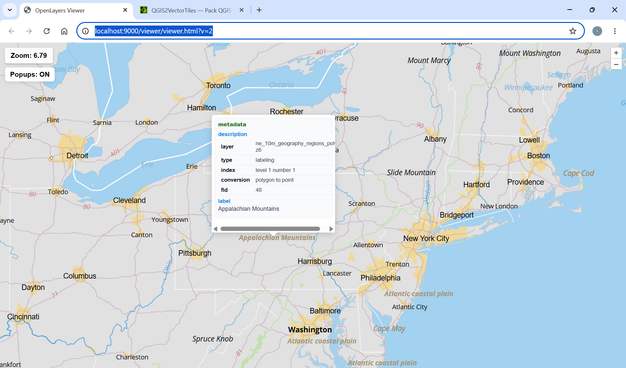
🚀 QGIS2VectorTiles v2.9 is out!
🔥 Following the addition of support in @openlayers, popups and style inspection, we are moving forward:
🧩 Added support for label largest part only.
💪 Limited maximum tile zoom to 16 (tiles only, not styling) to improve export speed and efficiency.
🛠️ Improved labeling visibility range handling and resolved related styling issues.
❤️🔥 Please rate and boost to support #FOSS
🔗 https://gallpeters.github.io/QGIS2VectorTiles/
#opensource #maplibre #vectortile #qgis #gdal #gis #openlayers
We are thrilled to welcome YellowMap as our newest silver sponsor!
Checkout our blog for more details: https://maplibre.org/news/2026-05-15-yellowmap-announcement/
Kicking off a series highlighting our most popular docs.
First up: Interactive Web Maps. We sort it by stack (React, Vue, Vanilla JS) and point you to the right library for your use case, with a quick start for each. Free signup if you don't already have an account.
#OpenStreetMap #MapLibre
https://docs.stadiamaps.com/maps-for-web/?utm_source=mastodon&utm_medium=social&utm_campaign=docs-series-maps-for-web
@JessFairbairn Ooofff, that is too much to expect
I'm leveraging the 'extrusion' rendering option of #MapLibre, but that is very limited. For example, sloped curves are not (yet?) possible, but that makes it hard to do e.g. stairs. So, small baby steps to fit my usecase (see a building and the rooms in 3D) and not much more then that
🚀 QGIS2VectorTiles v2.8 is out! Here’s what’s new:
🌐 Added support for @openlayers as an output viewer.
🪟 Pop-ups support in the web viewers.
🔍 Improved style inspection in outputs.
🛠️ Linux compatibility fixes.
With the new popups, you can now inspect features and trace their journey from QGIS canvas to the web browser ❤️🔥
Please use it, rate it, and help spread the word — Go #FOSS 🔥
https://gallpeters.github.io/QGIS2VectorTiles/
#cartography #openlayers #maplibre #vectortiles #qgis #gdal #gis #opensource