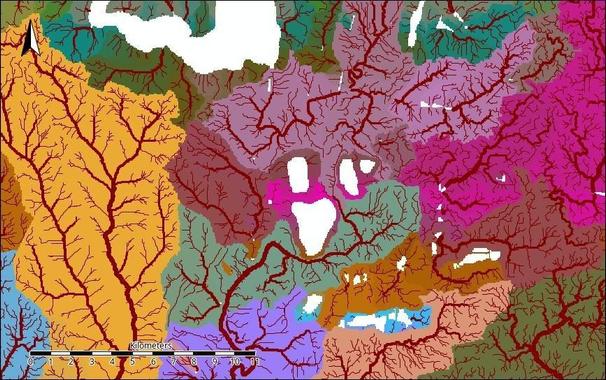
🔎 Preliminary watershed delineation for the Inhulets River study
One of the early intermediate products from my broader research on the anthropogenic impacts on the #InhuletsRiver.
This map shows a preliminary delineation of local drainage basins across the study area, derived from high-resolution DEM processing and hydrological modelling.
The goal of this stage is to establish a consistent spatial framework for later analyses — including flow pathways, contaminant transport patterns, and the interaction between surface and groundwater systems.
#GIS #Hydrology #Watershed #Geomorphology #OpenData #RemoteSensing #Geospatial #RStats #SAGA #QGIS #EnvironmentalScience #LandscapeGeochemistry #Copernicus #DEM #GeoDataArt