Whirling disease found in another Alberta watershed
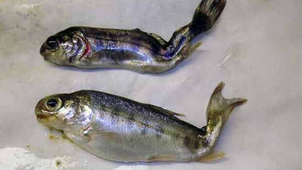
A microscopic parasite that attacks the cartilage and nervous system of young fish has been confirmed in the McLeod River, triggering a federal order to designate the Athabasca watershed in central Alberta as a contamination zone.
https://www.cbc.ca/news/canada/edmonton/whirling-disease-found-in-athabasca-watershed-9.7216067?cmp=rss