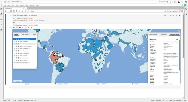
#30DayMapChallenge Day 17: A New Tool
🛠️ Tried #JupyterGIS, a #Python-based mapping tool in #JupyterLab, for mapping transboundary aquifers using open data from #IGRAC + #HydroSHEDS basins on an #OSM raster backdrop. What’s great? Real-time map+code collaboration, live annotations, and reproducible workflows. A promising lightweight, open alternative to traditional #GIS!