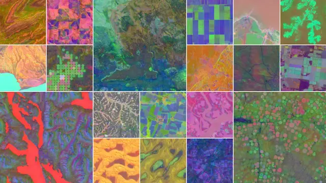
🌍 GIS Conference Opportunity

GeoSofia 2026 | 3D GeoInfo | SDSC | LADM & 3D LA will take place in Sofia, Bulgaria 🛰️🤖

Focusing on GIScience, remote sensing, and AI-driven spatial analysis for smart cities and sustainability 🌱🏙️

A great platform to present research and connect with the geospatial community. 🚀

🔗 Learn more: https://conference.gate-ai.eu/GeoSofia2026/

#GeoSofia2026 #GeoTech #GIScience #GeospatialAI #SpatialData #Geoinformatics #SmartCities #RemoteSensing #ResearchOpportunity

8 Critical Uses of Image Annotation in Geospatial AI

Image annotation helps AI understand satellite, aerial, and drone imagery for land cover mapping, road detection, disaster response, and environmental monitoring. These insights support smarter planning and data-driven decisions across industries.

Explore more: https://community.nasscom.in/communities/ai/8-critical-uses-image-annotation-geospatial-ai

#ImageAnnotation #GeospatialAi #ComputerVision #MachineLearning

Hello DSN Geospatial Community!

Join us at our bi-monthly webinar to learn how to turn crime data into smart maps that save lives; discover how QGIS powers spatio-temporal crime hotspot analysis and transforms numbers into smarter decisions.

Topic: Spatio-Temporal Crime Hotspot Analysis using QGIS: From Data to Decision-Making.

Date: Friday, 10th October 2025

Time: 4:00pm

Venue: DSN Community Telegram Channel.

#datasciencenigeria #GeospatialAI #QGIs

Satellites capture more than just images, they hold clues to floods, deforestation, and urban growth. But how do we transform those raw scenes into insights policymakers can use?

This week’s Geospatial Biweekly Webinar will dive into exactly that:
“Earth Observation Embeddings: From Scenes to Vectors with Foundation Models.”

Friday, 26th September | 4:00 PM WAT
DSN Geospatial Telegram Community

Be part of the conversation that’s shaping the future of climate resilience and geospatial innovation.

#datasciencenigeria #GeospatialAI #EarthObservation

For insurers, static maps aren’t enough. You need a geospatial engine built to integrate, scale, and perform at the speed of risk.

Qarta™, Quarticle’s geo‑intelligence engine, was built with modern insurance workflows in mind.

Find more information here: https://quarticle.ch/products/qarta

#GeoIntelligence #Underwriting #RiskAnalytics #InsurTech #Qarta #Geospatial #GeospatialAI #MachineLearning #GIS #BusinessIntelligence #PredictiveAnalytics #Quarticle #SpatialData #LocationIntelligence

Hello DSN Geospatial Community!

If you thought Part 1 was powerful, wait till you see what’s next.

We’re taking GIS automation to the next level in Part 2 of “Automating GIS Tasks with Python and QGIS.”

This session is all about real workflows, practical scripts, and techniques you can apply immediately.

✅ Advanced scripting in QGIS

✅ Smarter automation techniques

✅ Real-world geospatial task demos

Date: Friday, 8th August

Time: 4:00PM WAT

Venue: DSN Geospatial Telegram Community

Whether you joined Part 1 or not, this is your chance to catch the wave of smarter geospatial work.

No more manual steps. Just smart code, fast results

#datasciencenigeria #GeospatialAI

The future of smarter business strategies lies at the intersection of Geospatial AI and Machine Learning.

Explore this blog post and dive deeper into how cutting-edge technologies are unlocking new levels of spatial intelligence, helping businesses anticipate trends, optimize decisions, and gain a competitive edge: https://quarticle.ro/blog/geospatial-ai-and-machine-learning-the-key-to-smarter-business-strategies

#GeospatialAI #MachineLearning #GIS #BusinessIntelligence #PredictiveAnalytics #Quarticle #GeoIntelligence #SpatialData #LocationIntelligence #Innovation

Automate. Accelerate. Elevate.

Tired of repetitive GIS tasks? There’s a smarter way.

Join our next Geospatial Biweekly Webinar as we dive into Automating GIS Tasks with Python and QGIS — a hands-on session designed to transform how you work.

What you’ll learn:

a. How to streamline your workflows with Python scripting

b. Real use cases of automation in QGIS

c. Tips for scaling your geospatial analysis efficiently

Date: Friday, 25th July 2025

Time: 4:00PM WAT

Platform: DSN Geospatial Telegram Community

If you're into geospatial tech, data analysis, or just want to do more in less time — this is your call.

Haven't joined the group yet, join here> https://t.me/+YvF8TQvmYmRhNjdk

#datasciencenigeria #GeospatialAI #GeospatialScience