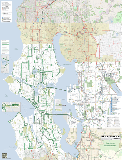

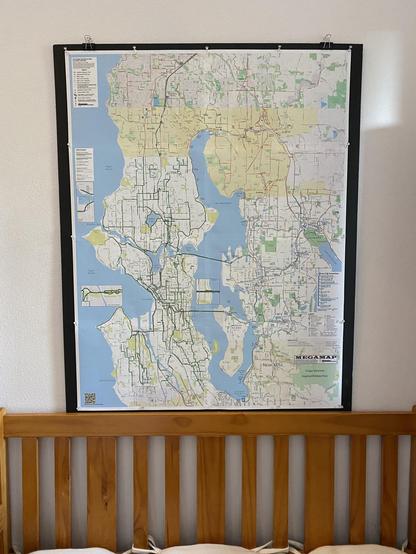
Been a minute since I've built a complete new physical MEGAMAP and hung it in the entryway
#BikeMap #maps #Northshore #GreaterNorthshore #MEGAMAP #biking #BikeTooter
Der #DigitalIndependenceDay hat inzwischen auch ein Wechsel-Rezept für #OpenStreetMap https://di.day/de/wechselrezepte/maps, wobei ein Hinweis auf weitere ~1997 apps 📱 nicht schaden könnte : https://osm-apps.org, oder auf "...Navi-Apps, die sich ganz aufs #Fahrradfahren 🚵 spezialisiert haben, etwa #Bikemap, #Naviki #komoot, #OpenCycleMap" https://www.chip.de/news/Radfahrer-sollten-Sie-kennen-Diese-Karte-zeigt-was-Google-Maps-nicht-kann_182872724.html
Beitragen ✍️ mit dem #Smartphone : https://www.openstreetmap.de/beitragen/smartphone/
#DID #DUT #DigitaleSouveränität #Gastronomie #Tourismus #OpenData
Been a minute since I've built a complete new physical MEGAMAP and hung it in the entryway
#BikeMap #maps #Northshore #GreaterNorthshore #MEGAMAP #biking #BikeTooter
@MHowell If I say "You gotcher god damned maps, what the hell else do you want?" like three people would get it but they'd appreciate it.
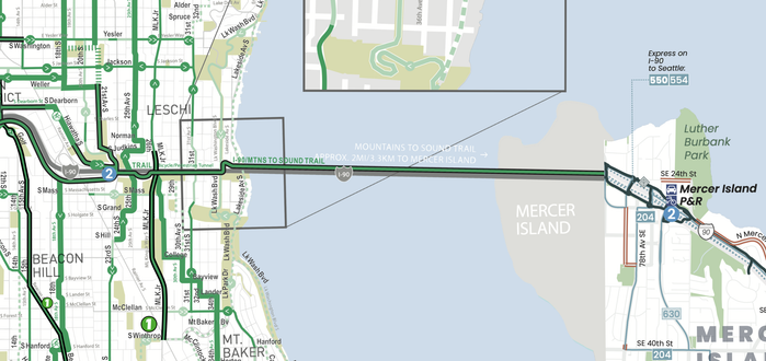
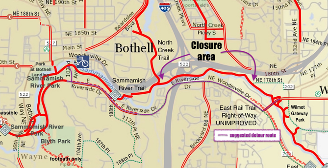
#BikeTooter #map #maps #BikeMap #GreaterNorthshore #closure #SammamishRiver #SammamishRiverTrail #biking
RELEASE: Greater Northshore and MEGAMAP Bike Maps version 2.1 - 17 April 2026
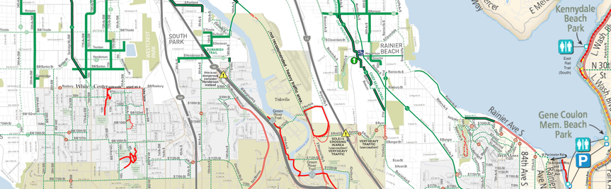
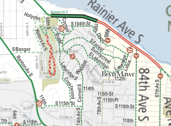
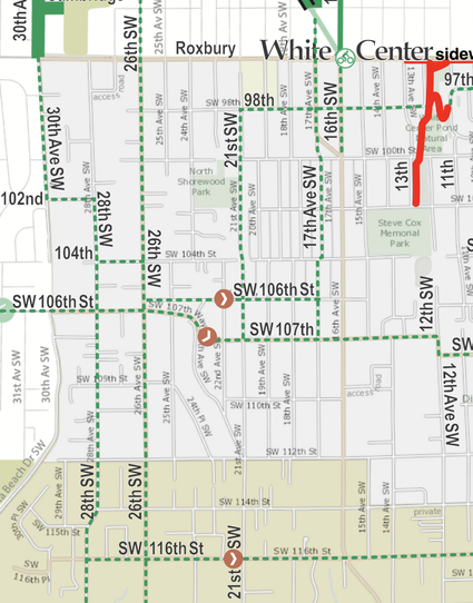
This is a massive update if you're in south Seattle or nearby environs. Welcome to coverage WHITE CENTER/TOP HAT, GLENDALE, BOULEVARD PARK, SOUTHERN HEIGHTS, LAKERIDGE, BRYN MAWR, and northernmost TUKWILA.
As always, check the blog post for the deets:
https://solarbird.net/blog/2026/02/13/maps-release-greater-northshore-bike-connector-megamap-2-0-8/
Maps download:
https://github.com/solarbirdy/NorthshoreBikeMap/
Previous permalinks continue to work.
If you like these maps, maybe hit my Patreon:
https://www.patreon.com/solarbird
Enjoy!
#BikeMap #maps #GreaterNorthshore #seattle #shoreline #redmond #lynnwood #LakeForestPark #Kenmore #Briar #Bothell #Woodinville #Juanita #Kirkland #RatCity #Glendale #Lakeridge #BrynMawr #tukwila #WhiteCenter #TopHat
Bryn Mawr means "Big Hill" in Welsh, so I call _this_ neighbourhood naming "truth in advertising." xD
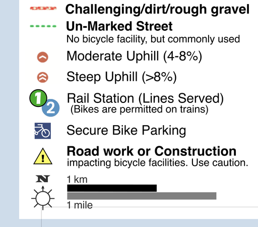
well I figured out why Roxbury gets used west of 16th
it's because it's the ONLY east-west that doesn't get a 4-8% slope marker
also it has de facto bike lanes - it got narrowed there a while ago to three lanes, two traffic and a turn - but the pavement isn't up to grade for Seattle (which does apparently own that street in its entirety) won't certify them
Should I add the "commonly used" to reflect that reality? but only to 18th at very most.
eta: WAIT NO IT'S JUST FURTHER WEST
and still less steep but still over 4%
So I guess will NOT be adding that until and unless the bike lanes become official
And that's a preliminary / RC1 maps release out to Patreon. Enjoy!