MAPS 2.0.2 quick release tonight! The biggest update is the Redmond Central Connector being open to NE 124th where it joins RailTrail.
See the README for a full list of changes.
https://github.com/solarbirdy/NorthshoreBikeMap
Real announcement tomorrow, this is for anybody still up tonight xD
#GreaterNorthshore #BikeMaps #maps #seattle #northshore #KingCounty #SnohomishCounty #BikeTooter
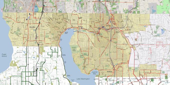
GitHub - solarbirdy/NorthshoreBikeMap: A bike infrastructure mapping project for NW King and SW Snohomish counties, The Greater Northshore Bike Map links the Seattle and 2 Line Eastside maps, making them all more useful. Printed, it folds as small as 4x8½". The MEGAMAP edition combines those maps plus Greater Newcastle into a large foldable poster for display or backpack use.
A bike infrastructure mapping project for NW King and SW Snohomish counties, The Greater Northshore Bike Map links the Seattle and 2 Line Eastside maps, making them all more useful. Printed, it fol...