Drones Adopt 3D Mapping to Navigate GPS-Denied Zones

As adversaries ramp up electronic warfare against GPS signals, drones are turning to 3D mapping to stay on course, even in zones where GPS is denied. This game-changing tech helps drones determine their exact position, ensuring they can navigate with precision, no matter what.

https://osintsights.com/drones-adopt-3d-mapping-to-navigate-gps-denied-zones?utm_source=mastodon&utm_medium=social

#GpsdeniedNavigation #3dMapping #UnmannedAerialVehicles #ElectronicWarfare #EmergingThreats
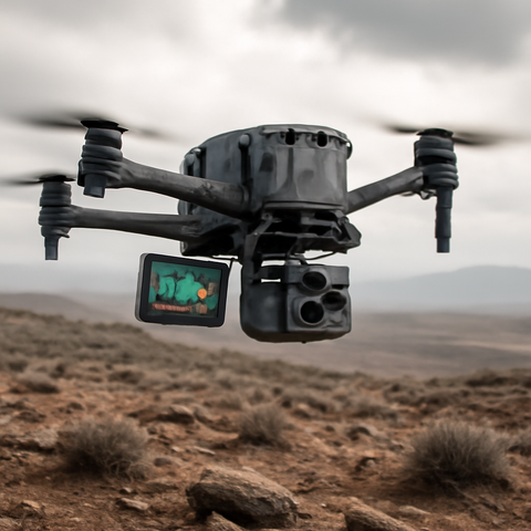
Drones Adopt 3D Mapping to Navigate GPS-Denied Zones

Learn how drones use 3D mapping to navigate GPS-denied zones, enhancing their autonomy and reliability - discover the latest advancements in drone technology now.

OSINTSights

Terrestrial Photogrammetry Software Market is witnessing strong growth driven by rising demand for 3D mapping, infrastructure surveying, digital twin development & advanced geospatial analytics across construction, mining & urban planning sectors.

Explore insights: https://reedintelligence.com/market-analysis/terrestrial-photogrammetry-software-market

#PhotogrammetrySoftware #3DMapping #MarketResearch

Terrestrial Photogrammetry Software Market Size, Share & Growth Report

The global Terrestrial Photogrammetry Software Market size was valued at USD 1.05 billion in 2026 and is projected to reach USD 2.45 billion by 2034, expanding at a CAGR of 11.3% during the forecast period (2026–2034).

Korea Times: Naver turns all of Seoul into 3D digital map experience. “Naver said Friday that its Naver Map platform has expanded coverage of its ‘Flying View 3D’ service across the entire capital, allowing users to virtually navigate Seoul’s landmarks, neighborhoods and natural scenery in high-resolution 3D imagery.”

https://rbfirehose.com/2026/05/16/korea-times-naver-turns-all-of-seoul-into-3d-digital-map-experience/
Korea Times: Naver turns all of Seoul into 3D digital map experience

Korea Times: Naver turns all of Seoul into 3D digital map experience. “Naver said Friday that its Naver Map platform has expanded coverage of its ‘Flying View 3D’ service across t…

ResearchBuzz: Firehose
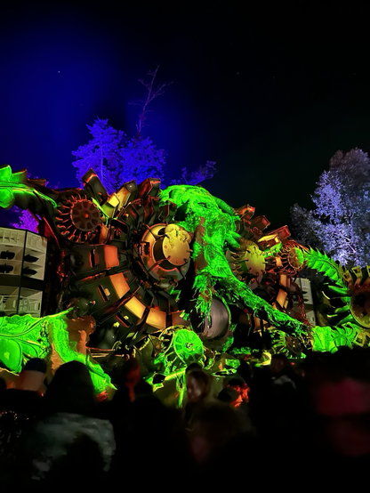
Masters of Puppets 2025
#hitech #psytrance #3Dmapping

Day 6/100: Antarctica doesn't look like this (but what if it did?) ❄️☁️

200m resolution elevation data from RAMP rendered in #ThreeJS with a twist: fluffy clouds instead of ice and rock.

Pure visual experimentation.
Workflow: #QGIS → export as image → Three.js fly navigation + transparent texture

Sometimes maps don't need realism. Sometimes looking at data in an unfamiliar way reveals patterns you wouldn't notice otherwise.

#100DayMapChallenge #WebGL #3DMapping #Antarctica

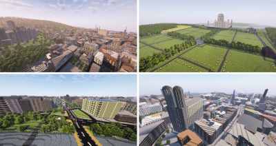
Arnis Brings The World To Minecraft: Bedrock Edition

A couple of years ago, we covered a project called Arnis, created by [Louis Erbkamm], which allowed you to generate any portion of Earth into Minecraft blocks and maps. It was already impressive, b…

Hackaday

🧭 **Làm 'sống lại' Kinh đô Thăng Long và tinh thần đạo học**

Triển lãm trình chiếu 3D Mapping "Kinh đô Thăng Long" kết hợp trưng bày "Đạo học ngàn năm" đã thành công tái hiện hình ảnh Kinh đô Thăng Long cổ xưa và khơi dậy tinh thần đạo học trong cuộc sống đương đại.

#ThangLong #KinhDoThangLong #DaoHoc #DiSan #VanHoaVietNam #Heritage #Culture #3DMapping

https://vietnamnet.vn/lam-song-lai-kinh-do-thang-long-va-tinh-than-dao-hoc-2477622.html

Làm sống lại Kinh đô Thăng Long và tinh thần đạo học

Trình chiếu 3D Mapping 'Kinh đô Thăng Long' cùng trưng bày 'Đạo học ngàn năm' đã làm sống dậy Kinh đô Thăng Long xưa và tinh thần đạo học trong đời sống hôm nay.

Vietnamnet.vn

Ein Forschungsteam der TU #München hat erstmals weltweit alle #Gebäude erfasst.

Der Global Building Atlas dokumentiert 2,75 Milliarden Bauten und liefert 3D-Daten zu Volumen und Höhe. Die Analyse zeigt deutliche Unterschiede beim #Gebäudevolumen pro Person.

Während #Finnland fast 4000 Kubikmeter bietet, sind es in #Niger nur 14. Die Daten sollen helfen, #Stadtentwicklung gezielter zu planen und soziale Ungleichheiten sichtbar zu machen.

https://www.n-tv.de/wissen/So-viele-Gebaeude-gibt-es-heute-auf-der-Erde-id30099940.html

#3DMapping #Städtebau

Erstmals komplett erfasst: So viele Gebäude gibt es heute auf der Erde

Forscher der TU München zählen erstmals alle Gebäude der Welt. Ihre neue 3D-Karte erfasst 2,75 Milliarden Bauten in nie gekannter Genauigkeit. Die Daten offenbaren aber auch drastische Unterschiede im weltweiten Wohlstand.

ntv NACHRICHTEN
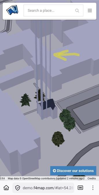
Measured in cm, mapped in meters, oops. Hopefully it'll render okay tomorrow. #f4map #OpenStreetMap #3dmapping