Glenn Moncrieff

104 Followers
139 Following
11 Posts
Geospatial ML in South Africa.
Deep learning | Remote Sensing | Biodiversity | Maps
GitHubhttps://github.com/GMoncrieff
Websitehttps://gmoncrieff.github.io
LinkedInhttps://www.linkedin.com
@adrian @jmopp you can get the national historical aerial photos (the whole country approx every 10 years since 1940) at that site under the aerial photography tab. They are not georeferenced, and it is not straightforward to work the site - but the JPEG’s are there
@adrian Nice. I actually just use the WMS feed in QGIS

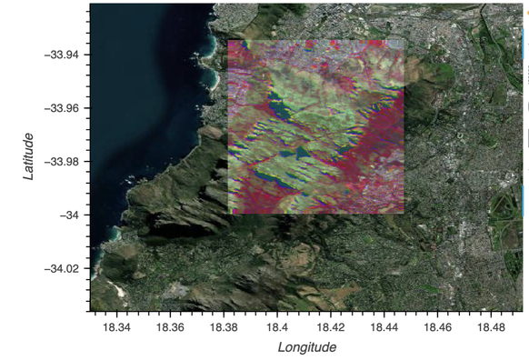
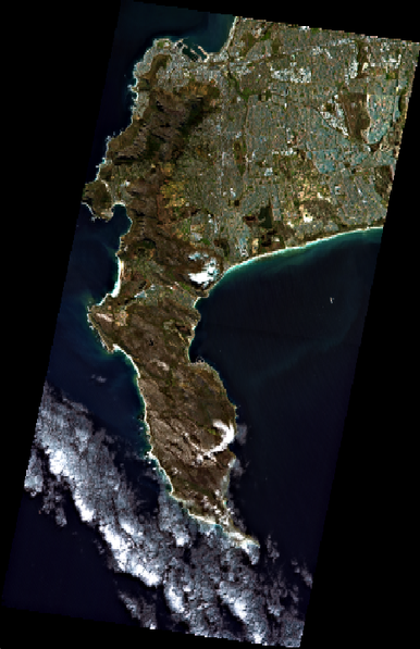
Cape Town has a 100-yr archive of high-res aerial photos. It is mind-bending to watch your home evolve through colonization, apartheid, and the modern era in up to 7cm resolution. Here a community - distinct 6 - is destroyed by apartheid spatial planners, and tries to start over.

Here is a link to view the data:
https://citymaps.capetown.gov.za/EGISViewer/

City of Cape Town Map Viewer

@koen_hufkens I work for one of these networks and I couldn't agree more. If you ever reach consensus, by that time the technology has moved on and needs have changed

The best way to quickly explore EnMAP #hyperspectral data is with the QGIS EnMAP box plugin. But if you want to do scalable ML you might want to try xarray and dask-ml. Here is an (unpolished) notebook to get you started

https://github.com/GMoncrieff/xarray-enmap

GitHub - GMoncrieff/xarray-enmap: notebooks to get started working with enmap hyperspectral data in python

notebooks to get started working with enmap hyperspectral data in python - GitHub - GMoncrieff/xarray-enmap: notebooks to get started working with enmap hyperspectral data in python

GitHub
mmm... a juicy first look at hyperspectral data for Cape Town from
EnMAP. This is a mosaic of 2 images from Sep 2022. And a sample spectrum from the top of Table Mountain #remotesensing
Henning Buddenbaum (@[email protected])

Attached: 1 image Downloaded my first #EnMAP data yesterday. Nice cloud free one of #Trier

Mastodon
I read the announcement that data from the DLR #hyperspectral satellite EnMAP is now publically available. But it is not entirely clear from the data access portal what the process to get access involves https://www.enmap.org/data_access/
Anybody had any luck? #remotesensing
Data & Access - EnMAP

The German Spaceborne Imaging Spectrometer Mission

Hey #eochat #gischat folks- I’m new here! Here’s an #introduction:

➡️ I’m a forest fire research #scientist with #NRCan #CanadianForestService on the core science team of the #WildFireSat mission. I use satellite imagery like #Landsat #modis #Sentinel2 to map fires.

➡️ I am co-director and a founding member of #LadiesofLandsat and a co-host on the new season of #SceneFromAbove podcast.

➡️ I am a #GoogleDeveloperExpert in #EarthEngine. I am a co-editor of www.eefabook.org

Thanks for connecting!

@mkr very cool project. I think there is a big market of GIS people who want to use ML but don't know pytorch/tf. In general time series classifiers, unets and object detection (YOLO) are popular in remote sensing Check out torchgeo.readthedocs.io or https://mlhub.earth/models for ideas and pretrained models
Radiant MLHub - Models

Open Library for Earth Observations Machine Learning