FOSS4G Observatory

@OSS4gEO
103 Followers
81 Following
89 Posts
The FOSS4G Observatory (ex-OSS4gEO), is a 2- year activity funded by ESA through the permanently open call Future EO-1: EO Science for Society and carried out by Terrasigna. It is part of a wider ESA initiative to actively support and contribute to the open source community and it is intended as a seed action to better understand, represent and harvest the geospatial open source ecosystem.
FOSS4G Observatoryhttps://www.oss4geo.org/
Project pagehttps://project.oss4geo.org/
APIhttps://gitlab.terrasigna.com/ESA/oss4geo/api/-/wikis/home

New releases continue to arrive across the #geospatial #OpenSource landscape:
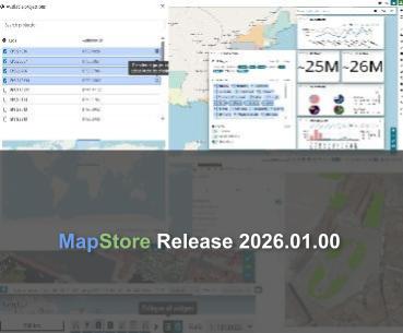
πŸ—ΊοΈ MapStore 2026.01
πŸ‘‰ https://www.geosolutionsgroup.com/blog/mapstore-2026-01-release/

πŸ”§ GeoTools 34.4
πŸ‘‰ https://geotoolsnews.blogspot.com/2026/05/geotools-344-released.html

🌍 GeoServer 2.28.4
πŸ‘‰ https://geoserver.org/announcements/vulnerability/2026/05/25/geoserver-2-28-4-released.html

πŸ“¦οΈ GDAL 3.13.0 Iowa City
πŸ‘‰ https://github.com/OSGeo/gdal/releases

Which update are you most interested in exploring?

MapStore 2026.01.00 Release - GeoSolutions

Information about release 2025.01.00 of MapStore. New Home Page, Look & Feel Enhancements, extended 3D features support...

GeoSolutions

RE: https://mastodon.social/@fsfe/116651530972351238

πŸ‡ͺπŸ‡Ί #EU funding for #FreeSoftware: The Restack programme is a new Horizon Europe initiative for:

πŸ”Ή Tech sovereignty & privacy
πŸ”Ή Internet resilience
πŸ”Ή Reducing environmental impact
πŸ”Ή Transparency in the supply chain

For the #FOSS4G community, such large programmes are essential, as they create the legal βš–οΈ, technical πŸ› οΈ , and potentially financial πŸ’°frameworks from which #geospatial projects can directly or indirectly benefit. Plus @fsfe will provide crucial legal and licensing support.

πŸ“š How to teach modern #GIS? Beyond simple program list!

The interactive graph from πŸ‘‰ https://www.oss4geo.org/ is a practical resource for #GIS, #Geography, #Geomatics, #DigitalCartography classes:

πŸ—ΊοΈ Software Landscape: Click any Desktop GIS to see its underlying libraries and connected tools.
πŸ”„ Data Flows: Trace the data path: Storage (Databases) ➑️ Publishing (Web Servers) ➑️ Visualization (Web-mapping).

🌐 πŸ–±οΈ An interactive way to teach interoperability and open standards! 🧩 🀝

FOSS4G Observatory

RE: https://mapstodon.space/@spatialists/116617890898933134

GeoParquet, an open format for geospatial vector data in #Apache Parquet, combining cloud-native analytics ⚑ with spatial metadata πŸ“„, is becoming increasingly present in geospatial workflows β˜οΈπŸŒπŸ“Š

The #OGC has published guidance for distributing #GeoParquet files, covering compression, spatial indexing & ordering, row group sizing, partitioning, and metadata.

It also includes practical commands for common tools to help generate optimized outputs βš™οΈ

πŸ‘‡πŸΌ
https://spatialists.ch/posts/2026/05/22-ogc-geoparquet-best-practices/

πŸ“‘ The #geospatial #ecosystem is increasingly converging around interoperable, cloud-native standards ☁️ πŸ›°οΈ

The #OGC has officially adopted #openEO as a Community Standard, another step toward API-first, interoperable #EarthObservation workflows 🌍

Together with STAC, COGs, and other cloud-native standards, openEO reflects the broader shift toward a more connected geospatial infrastructure πŸ”— πŸ—ΊοΈ

πŸ‘‰ https://www.ogc.org/announcement/openeo-api-ogc-community-standard/

openEO API Approved as OGC Community Standard for EO Processing

OGC publishes the openEO API as a new Community Standard to support interoperable and cloud-based Earth observation data processing.

Open Geospatial Consortium

RE: https://fosstodon.org/@grassgis/116544473036727579

πŸ‘€ Watching: @grassgis marks another major step forward for long-term #open #geospatial infrastructure.

Notable updates:
🐍 new grass.tools Python API
πŸ“Š JSON output across many tools
πŸ“– Docs rewritten in Markdown
⚑ processing improvements + 22 new addons

Great example of long-term sustainability in the FOSS4G ecosystem πŸ‘
πŸ‘‰ https://grass.osgeo.org/news/2026_05_08_grass_8_5_0_released/

#opensource #geospatial #foss4g #python #markdown #gis

Another way of #FOSS funding is through grants πŸ’°, such as the @NSF grant for @grassgis (πŸ‘‰ https://grass.osgeo.org/news/2023_09_06_nsf_grant_awarded/) ✨ πŸ“’ #FOSS4G communities, take a look at the OpenSourceforScienceFund grant program https://os4science.org/

How is open source funded today? πŸ€”

More and more, the answer comes from the community 🌍

Crowdfunding for #GeoServer 3.0-RC highlights a clear trend in FOSS4G: users are no longer just consumers, but active contributors to development and maintenance πŸ”§

Beyond a single project or release, a broader emerging model of collective sustainability is taking shape 🀝

More context πŸ‘‰ https://geoserver.org/behind%20the%20scenes/2026/04/21/geoserver-3-rc-crowdfunding-success.html

#Opensource #geospatial #sustainability #community #FOSS4G

GeoServer 3.0-RC, a crowdfunded success story

🌍 #EarthDay - a reminder that open source isn't just about code, but about collective action.

From extending hardware life πŸ’» to satellite monitoring πŸ›°οΈ and community mapping of ecosystems🌱, #foss4g tools help us understand and protect our environment. Open data and open tools mean we can all contribute to a more sustainable future.

Beyond the maps πŸ—ΊοΈ, #opensource offers endless ways to live sustainably. These practical ideas are still relevant: πŸ‘‡
https://opensource.com/article/23/4/celebrate-earth-day-open-source

10 ways to celebrate Earth Day with open source

Even though we strive to live every day like Earth Day here on Opensource.com, today is an especially good day to discover new ways to help the planet.

Opensource.com
The #FOSS paradigm fosters many advantages well known in the community & even beyond. Yet one of the most fertile one might be its high adaptability & interoperability within the #FOSS4G ecosystem to answer increasingly complex requirements. Thus, it has lead, as expected and desired, to promising initiatives across various domains. Check out some of the #ESA initiatives that build on #FOSS4G: EOEPCA+ πŸ‘‰ https://eoepca.org/eoepcaplus/ and the Planetary Science Archive πŸ‘‰ https://psa.esa.int/psa/#/pages/home