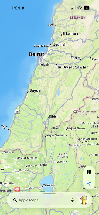
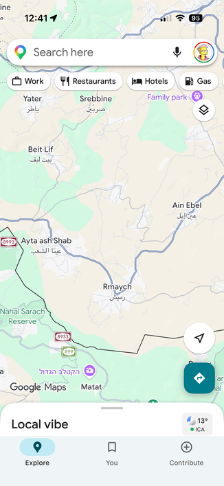
Apple Maps is showing Lebanon as a depopulated place. All village names erased.
Compare Lebanon, Syria and Israel.
Guess nobody lives there, they will need to send Israeli settlers to make the mountains and coastal resort towns flourish.
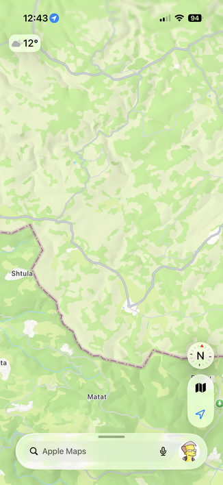
Apple Maps is showing Lebanon as a depopulated place. All village names erased.
Compare Lebanon, Syria and Israel.
Guess nobody lives there, they will need to send Israeli settlers to make the mountains and coastal resort towns flourish.
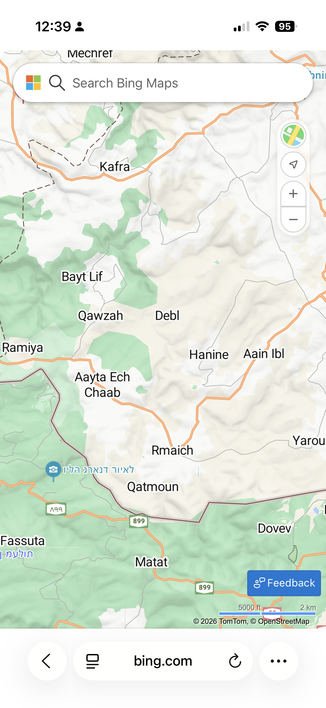
and the dashed lines showing the so-called disputed border around the Golan Heights...
an area that is in SYRIA, not israel. SMFH.
should not be in dispute - israel is simply an invading, occupying force when they aren't busy promoting religious extremism and terrorism
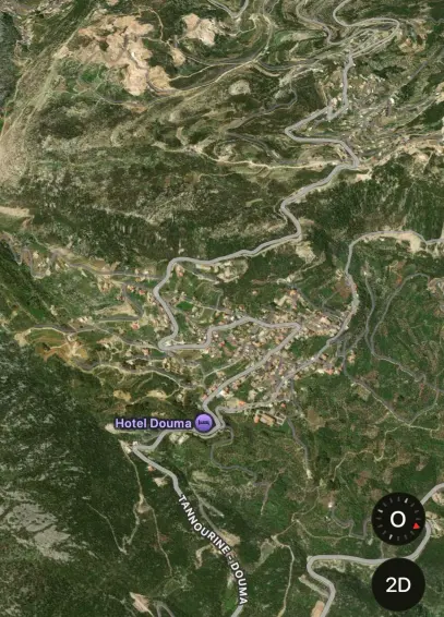
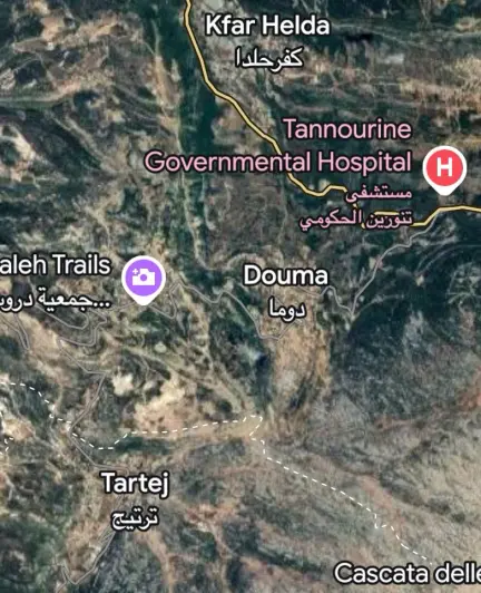
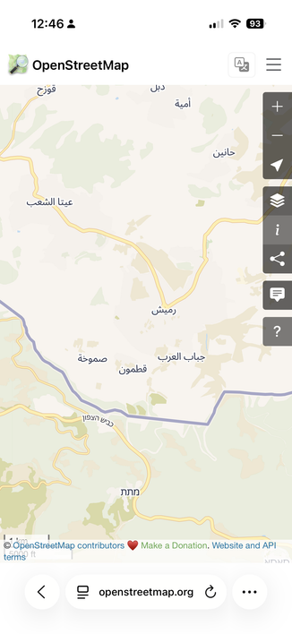
@xeno yes and bing maps which is not remotely as good has everything labeled.
This seems to be a recent and purposeful change.
Bing, google, Apple and open street maps:
@Migueldeicaza OT: I never noticed my user icon shows up on the search bar in Apple Maps.
I saw it on yours, thought “that’s not right”, and checked.
Sure enough, my icon is there.
@Migueldeicaza @xeno Without seeing it before the war it's hard to say if it is incompetence or planned.
But on Maps on macOS Matat didn't even show up initially for me and North Korea, as an example, is much more bare than Google Maps.
If the other maps go blank sure, but if it's to make people think there's nothing there then leaving it on Google maps & leaving the satellite images makes no sense.
They all rolled over on the gulf of America. I don't see Apple going out on their own on this.
@Migueldeicaza just downloaded the Lebanon map via comaps on iOS and it is a massive difference, checking Apple Maps it shows the same as yours though.
wtf?

