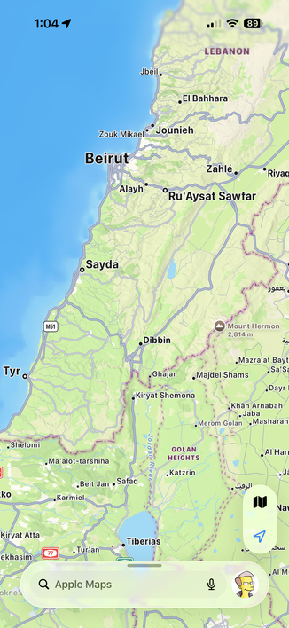
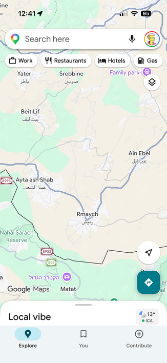
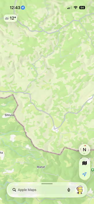
Apple Maps is showing Lebanon as a depopulated place. All village names erased.
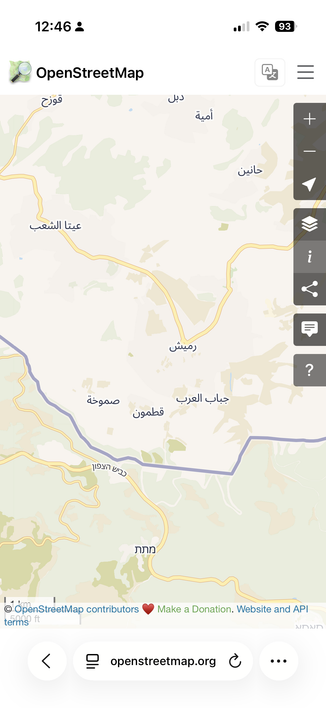
Compare Lebanon, Syria and Israel.
Guess nobody lives there, they will need to send Israeli settlers to make the mountains and coastal resort towns flourish.
Apple Maps is showing Lebanon as a depopulated place. All village names erased.
Compare Lebanon, Syria and Israel.
Guess nobody lives there, they will need to send Israeli settlers to make the mountains and coastal resort towns flourish.
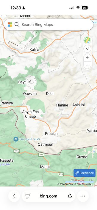
@xeno yes and bing maps which is not remotely as good has everything labeled.
This seems to be a recent and purposeful change.
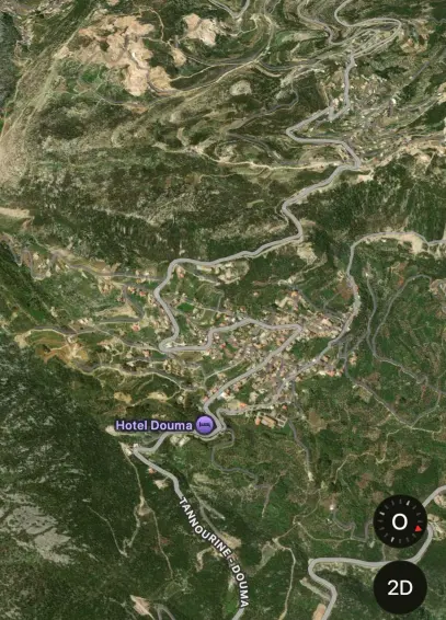
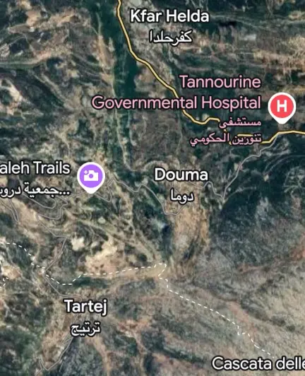
Bing, google, Apple and open street maps:
@Migueldeicaza OT: I never noticed my user icon shows up on the search bar in Apple Maps.
I saw it on yours, thought “that’s not right”, and checked.
Sure enough, my icon is there.
@Migueldeicaza @xeno Without seeing it before the war it's hard to say if it is incompetence or planned.
But on Maps on macOS Matat didn't even show up initially for me and North Korea, as an example, is much more bare than Google Maps.
If the other maps go blank sure, but if it's to make people think there's nothing there then leaving it on Google maps & leaving the satellite images makes no sense.
They all rolled over on the gulf of America. I don't see Apple going out on their own on this.
@Migueldeicaza This seems like one of those times where incompetence is much more likely than malice.
If it were malice, why would it just be Apple Maps? Someone would probably try to coordinate all the maps to do this simultaneously.
A data issue at Apple is far more likely. Someone fat-fingered a command and it removed all the cities in Lebanon and their QA process didn't catch it. Or the threshold for a city showing up on the map is population > X and someone messed up that value.
I used to work on an Internet maps team, though not at Apple, and these kinds of screw-ups happen. There are automatic release checks that are supposed to catch it. But, the checks tend to be "we messed this up once, let's catch it next time". There isn't much willingness to spend engineering time and effort creating new tests for theoretically possible scenarios.
