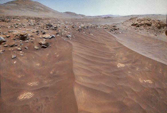
More Neretva Vallis regolith megaripples. This image was captured during #Flight64, about 30s before #Ingenuity landed.

Map follows.

Image captured from RMC 64.0001/5
Sol 955, LMST: 10:15:17

Processed, undistorted, leveled HELI_RTE
Original: https://mars.nasa.gov/mars2020-raw-images/pub/ods/surface/sol/00955/ids/edr/browse/heli/HSF_0955_0751711787_483ECM_N0640001HELI00005_000085J01.png
Credit: #NASA/JPL-Caltech/65dBnoise

#MarsHelicopter #Mars2020 #Solarocks #Space

Field-of-view of the RTE camera when #Ingenuity captured the image above during its #Flight64.

Made with #QGIS and data from #USGS #HiRISE and #MMGIS

#MarsHelicopter #Perseverance #Mars2020 #NASA #Solarocks #Space

@65dBnoise do you have or do you know of any good maps that show the entire journey of 64+ flights in one figure?
MMGIS

A web-based mapping and localization solution for science operation on planetary missions.

@65dBnoise If i'm not mistaken, that only shows Perseverence's path and the helicopter's current location.
@65dBnoise oh doh, filters! nevermind :)