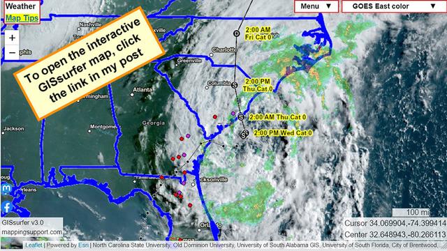
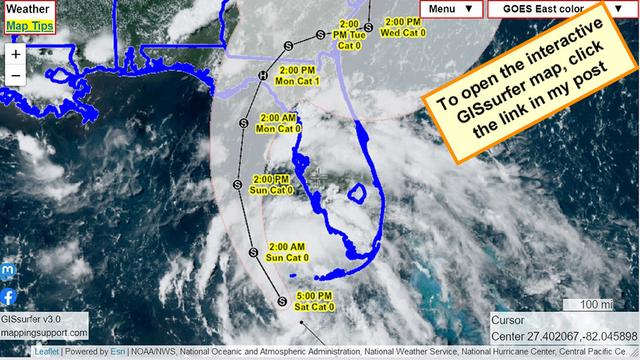
Aerial view of #TSDebby from GOES East satellite.
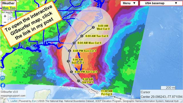
The small circles are streamgages that are currently showing either a major flood (Purple) or moderate flood (red). Keep in mind that there are a lot of streamgages where the water level for a ‘major’ or ‘moderate’ flood has not been defined.
Click any streamgage and follow the link to see a graph showing water level.
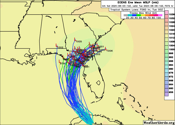
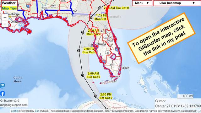
The map has lots of weather related GIS layers you can turn on/off/restack. To get the most benefit from the map see the “Map tips” link in the upper left corner.
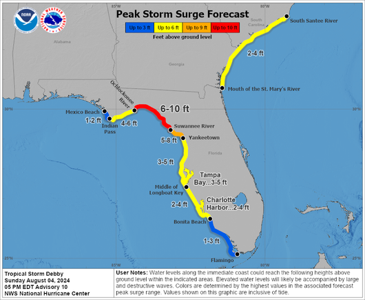
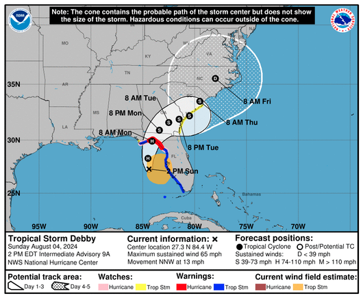
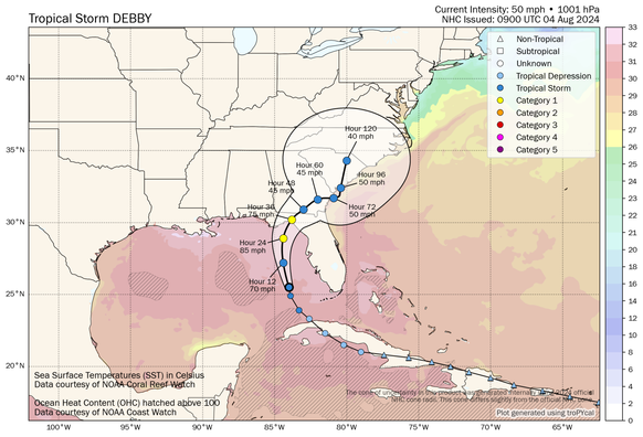
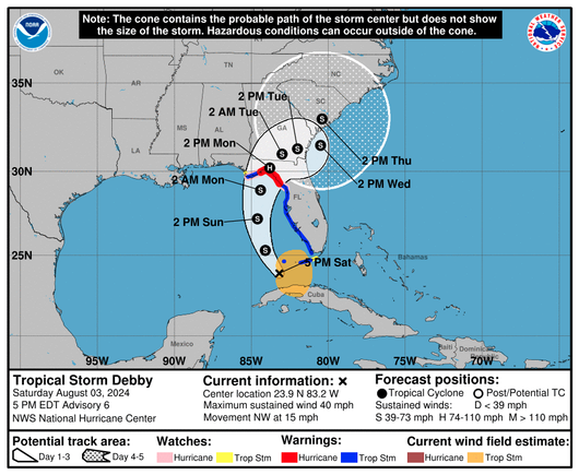
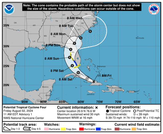
#Debby #FLwx #GAwx #SCwx #NCwx