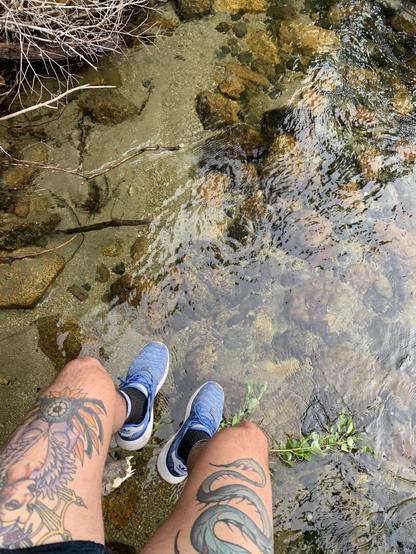
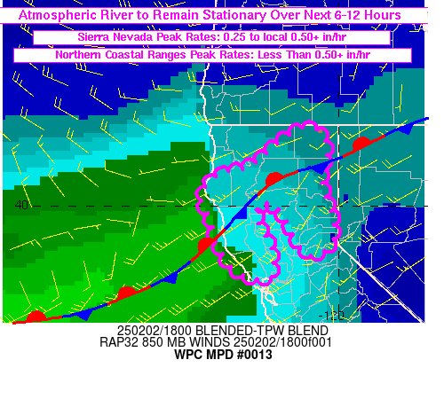
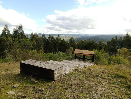
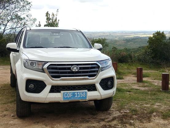
Ya me autorizaron para manejar las 4x4 del CURE y vamos a salir a buscar un fotómetro a la reserva de Ambá. Agarrate, ademas traje la poderosa para descargar los datos en medio de la llovizna #4x4 #yameiba #rocha #amba #sierras

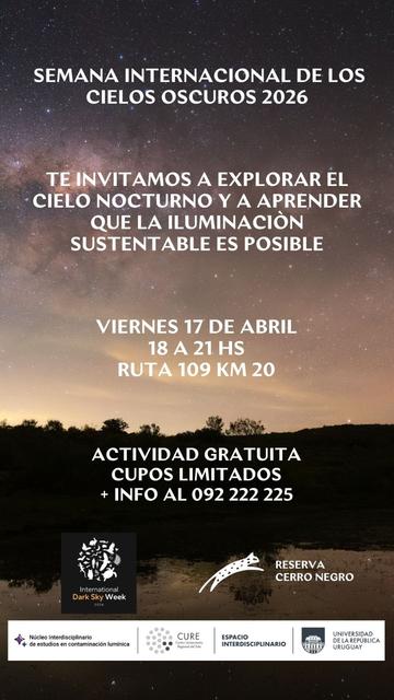
Jornada de Observación Astronómica en Sierras de Rocha (SUSPENDIDA)
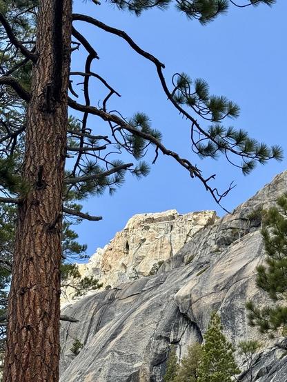
Rocha, viernes, 17 de abril, 18:00 GMT-3
Actualizacion 17/4 13:00hs: ACTIVIDAD SUSPENDIDA POR MAL TIEMPO
En el marco de la Semana Internacional de los Cielos Oscuros (IDSW) 2026 queremos invitarles a explorar el cielo nocturno, a simple vista y a través de telescopios, y a aprender que iluminar de forma sostenible para resguardar la oscuridad de la noche es posible, y más necesario que nunca.
VIERNES 17 DE ABRIL, 18 a 21 hs.
RESERVA CERRO NEGRO
Ruta 109 km 20, Sierras de Rocha.
INVITAN:
Ambá, Núcleo Interdisciplinario de Estudios en Contaminación Lumínica y Observatorio Astronómico del CURE.
Actividad para público general. Cupo limitado. En caso de mal tiempo se suspende.
https://plan.undernet.uy/event/jornada-de-observacion-astronomica-en-sierras-de-rocha
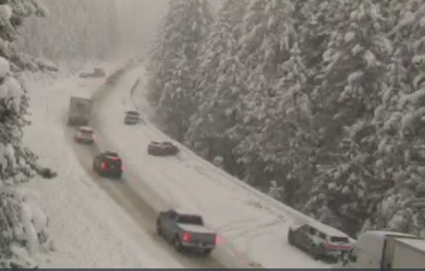
Ha ha haha Cmon people, this storm was forecast. You should not be off the side of the road stuck without chains.
(South Whitmore Grade/I-80 WB 2/16/26 0907PT)
Hiking eye-to-eye with the passenger jets
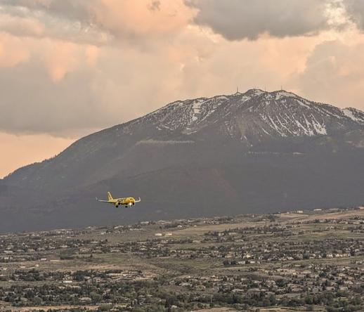
Spirit Airlines jet approaching Reno from Rattlesnake Mountain with the snowy Sierras in the background.It’s not often you have a chance from ground level to get eye-to-eye with a passenger jet let alone be above it while it’s still airborne. Well, if you are in the Reno area, be sure to hike 5,014 foot Rattlesnake Mountain, as you will get a close-up view of them as they are descending to land at Reno/Tahoe International Airport. FYI – This does depend on the wind direction.
With the Sierras as a backdrop, it’s 360 degrees of amazing views from Rattlesnake Mountain. Out and back, the trail is approximately 1.7 miles in length and you gain approximately 415 feet in elevation.
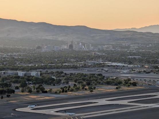
Jets preparing for takeoff with downtown Reno in the background. View from Rattlesnake Mountain.There are several approaches to the summit of Rattlesnake Mountain to choose from with varying degrees of steepness. Once near the summit, you are afforded splendid views of greater Reno, including a full-on vista of the airport, as well as a great view of downtown.
Rattlesnake Mountain and the adjacent hills in the Huffaker Hills Open Space form the east side of a narrow air corridor, along with the Sierras on the west side, that aircraft fly through on approach to Reno/Tahoe International Airport from the south.
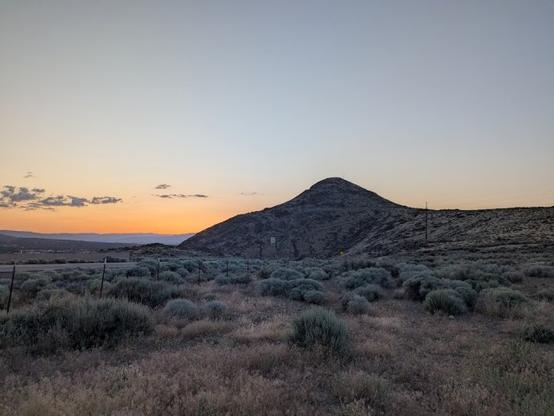
Rattlesnake Mountain at dusk from the Huffaker Hills Open Space Trailhead.So, if you love plane watching and cityscapes, Rattlesnake Mountain in Reno, Nevada is the place for you. After sunset, the lights of the city and airport must be even more amazing!
Peace!
Source: wikipedia.org#airTravel #airports #cities #fun #geography #hiking #history #landUse #Nevada #RattlesnakeMountain #Reno #Sierras #sightseeing #tourism #transportation #travel

This article about Noah discovering adaptive skiing was *such* a joy ⛷️⛰️
https://issuu.com/adventuresportsjournal/docs/winter_2024_issuu/32
#Sierras #California #BearValley #AdaptiveSkiing #TherapeauticRecreation #KabukiSyndrome #Tahoe #ASJ

Welcome to Issue #135, our winter edition. From the challenge of snow forecasting to planning a national parks itinerary, we hope this issue becomes your go-to resource for winter inspiration. Your support allows us to continue delivering inspiration to avid outdoor athletes and first-time explorers alike, sharing the wonder and spirit of the California outdoors with everyone who picks up our magazine.