The thread about a Christmas-themed A to Z of Edinburgh and Leith place names
For no particular reason other than the time of year, let’s take an A to Z look into some of the street and place names of Edinburgh and Leith and see what festive or seasonal connections we might find.
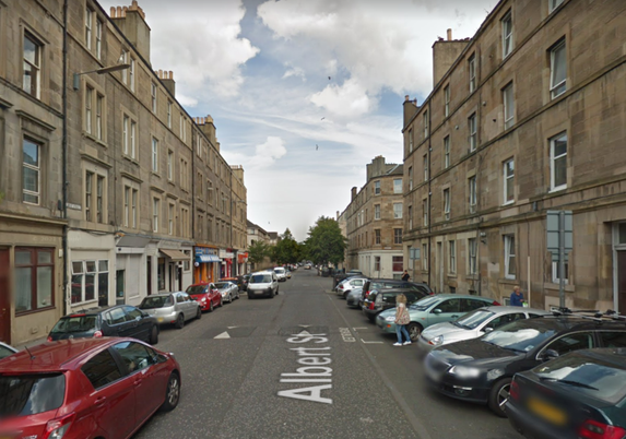
A Very Merry Xmas, a Christmas card featuring the spire of St. Giles High Kirk and a stylised Old Town roofscape c. 1900 © Edinburgh City LibrariesA is for Albert Street. This street in Leith was named for the Prince Consort, Albert of Saxe-Coburg and Gotha, around 1870 to commemorate his death in 1861. Albert is credited with introducing the first Christmas trees to Britain (he didn’t apparently it was Queen Charlotte – of Mecklenburg-Strelitz – in 1800)
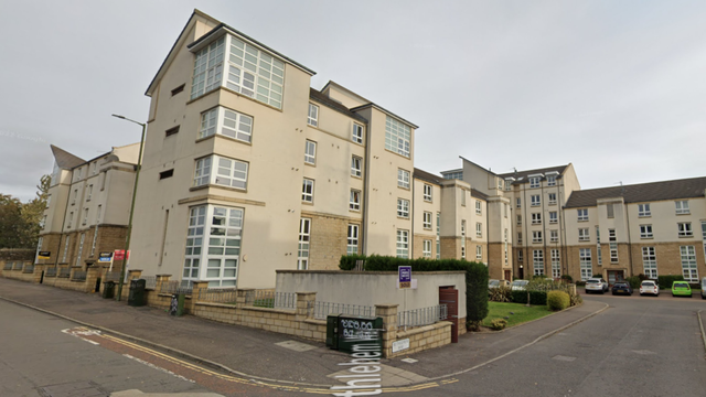
Albert Street, off Leith WalkB is for Bethlehem Way. This is a rather insipid development of modern flats in the Lochend area of the city, built on the site of the old Hawkhill Quarry. I’m afraid I cannot offer an explanation as to why this name was picked – this area has no biblical or Middle Eastern connection that I know of.
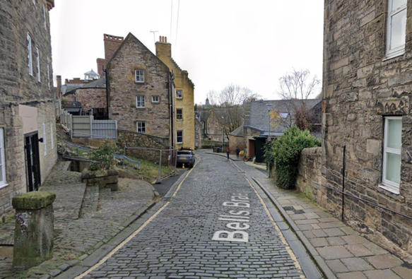
Bethlehem WayB is for Bell’s. There are a number of Bell place names in the city, but I have picked Bell’s Brae, that charmingly steep street that connects Queensferry Street to the Water of Leith Village (which you might call Dean Village). At one time this was in the parish of the West Kirk so had to be climbed each week to attend church, so this was known as the Kirk Brae. It was named Bell’s after the millers of that name further upstream at Bell’s Mill.
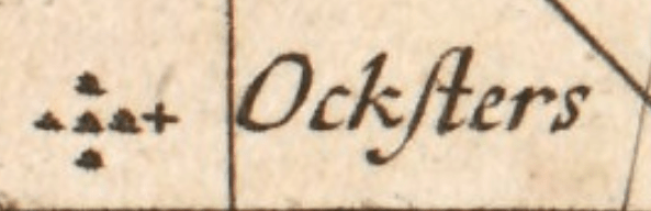
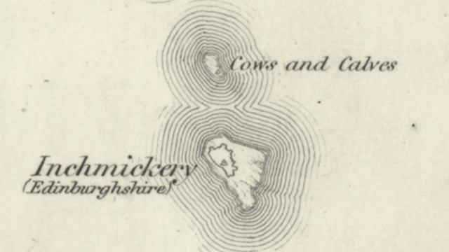
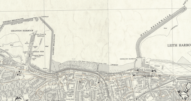
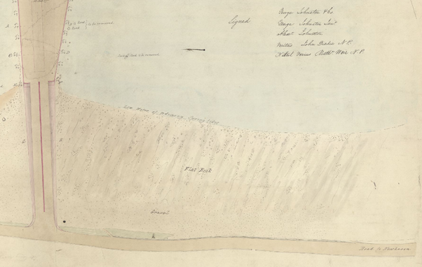
Bell’s BraeC is for Chestnut Street. This is named for a rock just off of Granton’s western breakwater and for a street name is rather odd as it was first named as late as 1985, before disappearing again when the industrial area of Granton docks was cleared. It was then being re-used in a street nearby within the last few years for new build housing. It is named for the rock of that name in the Forth.
Chestnut rock marked on a coastal chart. Reproduced with the permission of the National Library of ScotlandD is for Drum. As any parent knows, the worst gift you can ever receive for your small child is a drum. From the Gaelic Druim meaning literally “back”; it describes a ridge or raised ground. See also The Drum in Gilmerton, Drumbrae in Corstorphine, etc. The Drum in Leith is not that obvious now that it has been built on, but is the higher ground above Lochend Loch and was once a house and market garden of that name here, it was once the district name and is what the Hibernian F.C. ground was called before it was named Easter Road.
OS 1893 Town Plan, Reproduced with the permission of the National Library of ScotlandE is for Elf Loch. One of the sometimes overlooked bodies of water in the city boundary. Also called the Diedman’s Pool, this more festive name is possibly from the Gaelic ailbhinn or British elfin, meaning a rocky precipice, of which there are many nearby . An ancient, natural water feature it’s easily mistaken for a water obstacle on the golf course which surrounds it.
Elf Loch, cc-by-SA Richard WebbF is for Fir Hill. The suburb of Firrhill or Firr Hill is a mid-19th century mapmaker’s corruption of Fir Hill, in reference to the festive trees that grew there once upon a time. The school of this name features a fir tree on its badge and has the Gaelic motto Air Carraig, or “on the rock”.
“Fir Hill”. OS 6 inch survey, 1855. Reproduced with the permission of the National Library of ScotlandG is For Guse Dub. Guse is the old Scots word for a Goose, and the Dub referred to a pond and spring where geese were once raised. This has long been the name of a little corner of Causewayside, where it meets the Crosscauseway.
Guse Dub and Buccleuch Street. CC-by-NC Leo ReynoldsH is for Holly and I is for Ivy, two streets in the Merchiston and Shandon “colonies” houses built by the Edinburgh Co-operative Building Company, who often used the names of trees and flowers for their terraces of high-quality model workers houses.
OS 1893 Town Plan, Reproduced with the permission of the National Library of ScotlandJ is for St. Joseph’s, the name of a Catholic Church and Primary school in the Broomhouse area of the city. It was one of the last R.C. parishes in Edinburgh to be formed, to serve the expanding post-war population in the council housing estates in the west of the city.
St. Joseph’s RC Church, CC-by-SA 4.0 Walker287K is for the King’s Stables. Now the name of the road which connects Lothian Road to the Grassmarket, it was here in 1335 that Edward III of England’s occupying garrison built a royal stables for the King’s cavalry horses. As the centre of Royal power in the city migrated to Holyrood in the 16th century, the stables fell out of use and were sold in 1527. The name stuck though, and it has been as such ever since.
Castle from the King’s Stables Roads, unknown photographer and date. Cc-by-NC National Galleries ScotlandL is for Lamb’s House. OK, perhaps a bit contrived but I was struggling on this one and I’m pretty sure the shepherds brought at least one lamb with them to the stable in Bethlehem. Lamb’s House, named for the merchant and shipowner Andrew Lamb, is a 17th century house in Leith and one of that Port’s oldest buildings. It was sold by the National Trust for Scotland and restored in 2012.
The restored Lamb’s House, CC-by-SA 2.0 Stephen CravenM is for Mary. There are lots of Mary- place names in Edinburgh and more than a few churches and cathedral’s dedicated to her as a Saint. There are two Maryfields in Edinburgh. One was an old 1840s house at the head of Easter Road, giving its name to the area, and a current street and colony row in Abbeyhill. These fancy -field names after female relatives, were common. e.g. Annfield, Elizafield. Jessfield.
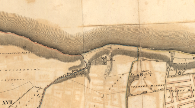
OS 1893 Town Plan, Reproduced with the permission of the National Library of ScotlandN is for St. Nicholas. If we go back to pre-reformation times, St. Nicholas was the chapel and burial ground of North Leith (although not its parish church). It was occupied by Cromwell’s Protectorate army after the Scottish Covenanters’ defeat at Dunbar in 1650, later being swept away when his Citadel was built in 1655. The only image I know if it is in the corner of the “Petworth House Map” of the Siege of Leith, when it was fortified as a strong point (note the trench around it and the cannons).
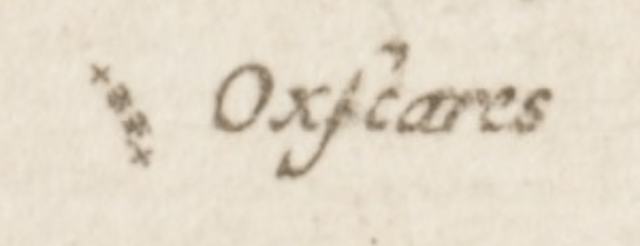
St Nicholas’ Chapel, from the 1560 “Petworth House Map” of the Siege of Leith. PHA 4640, Reproduced by the kind permission of Lord Egremont and with acknowledgements to the County Archivist, West Sussex Record OfficeO is for Oxford Street, both London’s centre of festive shopping and a short street in Newington. Named for Oxford Park which was here beforehand, the reason behind that is long lost to memory and time.
Oxford StreetP is for Perdrixknowe. The house of this name was built as Waverley House by the fountain pen magnate Duncan Cameron, but reverted to its old area name of Perdrixknowe (Partridge Hill) when converted into sheltered housing in the 1980s.
Perdrixknowe, once Waverley HouseQ is for Quality Street. Chocolates anyone? There were once two Quality Streets; one in Leith and one in Blackhall. Usually the duplicate streets in Leith and Edinburgh had one renamed to avoid postal confusion, in this case it was Leith that changed, to Maritime Street, which was ironic as the one in Blackhall was most likely named after it about 150 years later! It was possibly named after a fashionable property in London at the time.
OS Town Plan, 1849, Reproduced with the permission of the National Library of ScotlandR is for Red (as in Rudolph the Reindeer). There’s lots of Edinburgh place names with “Red” in them. Redford, Redbraes, Redheughs, etc. Redhall is one of the longest established, being recorded in the 13th century and referring to a hall house built out of the local reddish sandstone from the Redhall quarry. It was later fortified and eventually referred to as a castle. It was reduced by Oliver Cromwell’s New Model Army before the Battle of Dunbar in 1650 and fell into disrepair. George Inglis of Auchendinny later built a mansion house on the estate.
Redhall House. CC-BY-SA Anne BurgessS is for Sleigh Drive, named – along with a number of other streets in the Lochend council housing estate – after Sir William Lowrie Sleigh, DL, LLD, JP, Lord Provost of Edinburgh (1923–1926). The Corporation had a bit of a habit of naming their new housing schemes after recent Lord Provosts at this time (see also Chesser, Hutchison, Stevenson and Whitson). Sleigh made his name and money in the bicycle trade with a partner – Ross – trading under the name Rossleigh. they later moved into the motor and chauffeuring trade and are still going in the latter business.
Sir W. L. Sleigh by Cowan Dobson, © Edinburgh Museums and GalleriesT is for The East Way. How else did the Three Wise Men get where they were going? The East Way is a named footpath in the pioneering 1919 council housing development of Northfield which was laid out on Garden City principles with concentric rings of streets connected by footpaths. The others are named The North Way and The High Way.
The East Way, NorthfieldU is for Upper Bow. Bow (pronounced Bough, traditionally, but Bow these days) was an old Scots term for an arched gateway, and before the construction of the West Port the West Bow was the western entrance into the city. The street was an awkward, steep dog-leg, the upper part of which was the Upper Bow, the top being the Bowhead where in antiquity there was a tron or public weigh house in the centre of the Lawnmarket. When George IV Bridge was built in the 1830s, the West Bow was redirected to connect to it, leaving the Upper Bow as a little stub, connected to it by a public stairway.
V is for Victoria Street. It is the Victorians who are credited with popularising the celebration of Christmas in the UK after all, and instituting many of the British traditions associated with it. Conveniently, this is what the West Bow was renamed to when it was diverted to connect to George IV bridge, to commemorate the recent accession of Queen Victoria. It is one of Edinburgh’s most picture postcard little streets, but is usually covered in cars despite recent attempts to make it pedestrianised.
Victoria Street. CC-by-SA 3.0 Daniel KraftW is for Whisky Row. Now renamed Elbe Street to reflect Leith’s North Sea trade with Hamburg on that river, it was once an address of numerous wine and spirits merchants in the Port. Cheers! Slàinte is Nollaig Cridheil!
Ainslie’s Town Plan of 1804. Reproduced with the permission of the National Library of ScotlandX is for Nothing. What naughty children get in their stockings – but mainly as there are no X- placenames in Edinburgh or Leith.
Y is for Yool. Yool’s place was an old street in Portobello. Thomas Yool or Yoole set up the pottery on the site with his nephew, Thomas Rathbone and a business partner John Thomas, and gave his name to a short street. Pottery was the once prosperous industry of the town, built as it was by claypits to house the workers of the brick and later pottery industries. After Yool’s death the business continued as T. Rathbone & Co., by Rathbone’s son – John – before being bought in 1839 by new owners.
OS 1944 Town Plan. Reproduced with the permission of the National Library of ScotlandZ is for Nothing, there’s only one Z- placename in Edinburgh and that’s named after Zetland, the traditional county name for the Shetland Islands.
Note to readers: unfortunately in April 2026, a third-party plug-in more than exceeded its authority and broke many of the image links on this site. No images were lost but I will have to restore them page-by-page, which may take some time. In the meantime please bear with me while I go about rectifying this issue.
If you have found this site useful, informative or amusing then you can help contribute towards its running costs by supporting me on ko-fi. This includes my commitment to keeping it 100% advert and AI free for all time coming, and in helping to find further unusual stories to bring you by acquiring books and paying for research.
Or please do just share this post on social media or amongst friends and like-minded people, sites like this thrive on being shared.
Explore Threadinburgh by map:
Travelers' Map is loading...If you see this after your page is loaded completely, leafletJS files are missing.
These threads © 2017-2026, Andy Arthur.
NO AI TRAINING: Any use of the contents of this website to “train” generative artificial intelligence (AI) technologies to generate text is expressly prohibited. The author reserves all rights to license uses of this work for generative AI training and development of machine learning language models.
#Lochend #Logan #Restalrig #StMargaret